

COUPON CODE SUMMER24 GET 10% OFF
(Tempest is an affilllate of Meteorologist Joe Cioffi & earns commissions on sales.)
Hurricane Isaias Begins Final Approach Today
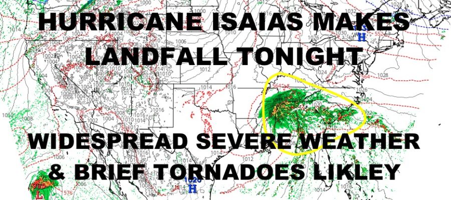
Good morning everyone. We continue to watch Hurricane Isaias as it intensified into a Category 3 hurricane overnight/early this morning. A few days ago, I cautioned about underestimating this to be a Cat 1 or 2 at landfall simply because gulf storms can rapidly deepen. Sadly, this has come to fruition. As of this moment, we are looking at winds clocking in at 120mph with NNE movement at 15mph. This will bring us into an approximate landfall sometime between 10pm and 1am in the eastern Panhandle of Florida; likely in proximity to Pensacola.
SATELLITE

Due to further strengthening, I’d also up the numbers on the expected storm surge. Previously, a 4-7ft storm surge was expected, but at this time, I think the peak surge could reach 9’+ in areas hardest hit. For those along immediate coastal sections likely to receive the full brunt of Isaias, this is a life-threatening storm. The time to evacuate is now. Looking at the satellite, we see some more intensification happening around the eye wall, so don’t be surprised if Isaias possibly hits a Category 4 prior to landfall.
Once Isaias makes landfall, we will be dealing with widespread torrential rain, and tropical storm force winds. We’ll also contend with a tornado threat that could span from the Carolina coast, down across Florida, Georgia, Louisiana, Mississippi, Alabama, Tennessee, and Kentucky.
WEATHER RADAR

For the NYC area, we have a beautiful day today with sunshine and low 70’s. Clouds increase tomorrow under more low 70’s; then we’ll see rain creeping in Sunday into Monday due to Isaias’ remnants.
Clearing and 70’s resume Tuesday, then things cool off midweek next week.
BE SURE TO DOWNLOAD THE FREE METEOROLOGIST JOE CIOFFI WEATHER APP &
ANGRY BEN’S FREE WEATHER APP “THE ANGRY WEATHERMAN!
MANY THANKS TO TROPICAL TIDBITS FOR THE USE OF MAPS
Please note that with regards to any severe weather, tropical storms, or hurricanes, should a storm be threatening, please consult your local National Weather Service office or your local government officials about what action you should be taking to protect life and property.