

COUPON CODE SUMMER24 GET 10% OFF
(Tempest is an affilllate of Meteorologist Joe Cioffi & earns commissions on sales.)
Nor’Easter Possibly Impacts East Coast This Week
Good morning everyone. We have 3 features on the map we’re watching very closely. The first is a strong cold that’ll swing by overnight, but not before a couple of waves of showers and storms. The first one is occurring as we speak, with showers and embedded rumbles passing mostly to the north of NYC. However, we see a tail stretching down across NJ that’ll brush the NYC and LI area. The second feature is relatively chilly air and blustery conditions behind that front.
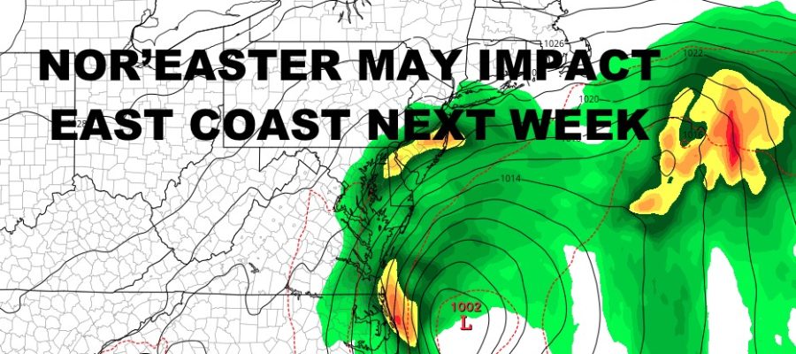
Unfortunately, the 3rd feature will be that cold front unable to fully clear the East Coast; with a wave of low pressure forming off of the Mid-Atlantic. Building high pressure won’t allow it to leave as it deepens, which will set the stage for a possible Nor’Easter and wide-ranging/long-lasting impacts from early next week, into possibly next weekend depending on some of the models.
Check out the latest below on what this means for the NYC area and the rest of the East Coast….
SATELLITE

The first wave of showers and storms has cleared the area except for eastern Long Island. Beyond that, we could see some blue breaks in between the next couple of waves of scattered showers and storms. Some of those storms, especially west of the NYC area, could reach severe limits. We are already seeing that in western NYS and and NW PA. Highs today will be a muggy 75-80.
Overnight tonight, stiff westerlies increase as we begin to dry out late. Lows will dip into the upper 40’s to near 50; chillier N&W of NYC.
WEATHER RADAR

We’ll have decreasing clouds tomorrow, blustery conditions and highs in the 50-55 range. Overnight, look for lows to dip into the mid to upper 30’s. Away from the NYC area, some spots could see their first frost and freezes. Sunday improves a bit with lighter winds and highs in the mid to upper 50’s. However, we’ll be watching that possible system off of the Mid-Atlantic.
IF things do come to fruition with a developing Nor’Easter, we’ll have to scratch the current forecast of sunshine Monday and Tuesday and 60-65 degree temps. We’ll be watching it closely as the chance is increasing for some non-tropical development off of the Mid-Atlantic. There are many “ifs” going on right now, but IF we see a system and IF it sticks around due to blocking, it could have some ramifications for the coast, especially for the Outer Banks of NC.
Going by the GFS and Euro and what they’re depicting this morning, we may have increasing clouds late Sunday, then a brushing of showers and stiff onshore winds some time Monday and Tuesday. This would result in rough surf, enhanced tides, and possible minor coastal flooding. For the Outer Banks, we could see heavier rain, heavy surf, coastal flooding, and major beach erosion.
Stay tuned and we will keep a close eye on it.
BE SURE TO DOWNLOAD THE FREE METEOROLOGIST JOE CIOFFI WEATHER APP &
ANGRY BEN’S FREE WEATHER APP “THE ANGRY WEATHERMAN!
MANY THANKS TO TROPICAL TIDBITS FOR THE USE OF MAPS
Please note that with regards to any severe weather, tropical storms, or hurricanes, should a storm be threatening, please consult your local National Weather Service office or your local government officials about what action you should be taking to protect life and property.