

COUPON CODE SUMMER24 GET 10% OFF
(Tempest is an affilllate of Meteorologist Joe Cioffi & earns commissions on sales.)
NYC Deep Summer Stretch Ahead
Good afternoon everyone. We have typical summer conditions over the course of the next few days, then heat and juicy conditions return to start next week. There is a chance of a summer reprieve late next week after a round of heavy thunderstorms; then possibly very pleasant conditions for the weekend of the 18th. Check out the latest below…
SATELLITE

For the rest of the day on into tonight, low 80’s will give way to upper 60’s and peachy fog as humidity increase. Tomorrow looks warm and humid, with increasing clouds and the chance of some PM thunderstorms. Some of those storms could be on the heavy side. Highs in the mid 80’s.
WEATHER RADAR

For Friday, look for a very warm to hot day, with the chance again for some scattered PM storms. Highs will be a juicy upper 80’s to near 90. Your weekend looks rather tame, with seasonably warm conditions under a mix of sun & clouds. Highs in the low to mid 80’s.
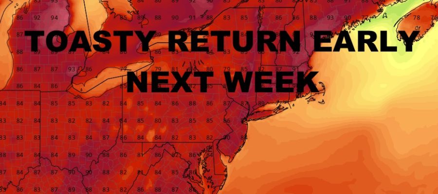
To start your workweek next week, we are in the mid to upper 80’s with sunshine; then by Tuesday we are back into the low 90’s. Wednesday look like the hottest day next week ahead of our next system. Highs could reach the mid to upper 90’s. We’ll watch for the timing of that front to see what happens Thursday. However, we could see 75-80 degree temps the weekend of July 18th if things work out.
BE SURE TO DOWNLOAD THE FREE METEOROLOGIST JOE CIOFFI WEATHER APP &
ANGRY BEN’S FREE WEATHER APP “THE ANGRY WEATHERMAN!
MANY THANKS TO TROPICAL TIDBITS FOR THE USE OF MAPS
Please note that with regards to any severe weather, tropical storms, or hurricanes, should a storm be threatening, please consult your local National Weather Service office or your local government officials about what action you should be taking to protect life and property.