

COUPON CODE SUMMER24 GET 10% OFF
(Tempest is an affilllate of Meteorologist Joe Cioffi & earns commissions on sales.)
NYC Flooding Potential Tomorrow
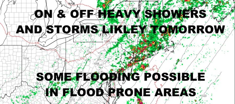
Good afternoon everyone. We’re watching a slow moving storm system trudge along to the east/northeast, brining with it, heavy showers and thunderstorms. Eventually, that energy will get into our area, and we expect the chance of rain and thunder to increase as the even and nighttime wear on. Check out the latest below…
SATELLITE

We finish our day off today with muggy conditions and more clouds than sun. Look of the risk of a stray shower or storm. Highs will stick around 80 degrees. We’ll up the risk of scattered showers and storms overnight, then we go full bore tomorrow. It’ll be another muggy one with upper 70’s to low 80’s, and an increased chance of on and off showers and heavy thunderstorms. We can’t rule out risk of locally severe conditions, but the biggest risk looks like flash flooding in flood prone and already saturated areas.
WEATHER RADAR

Tuesday looks to be the only sunny day of the bunch, with highs in the 80-85 degree range. A mix of sun & clouds returns on Wednesday, and we turn up the juice a bit with more muggy conditions. Highs in the mid 80’s.
Look for sun & clouds both Thursday and Friday, the risk of widely scattered showers & storms, and highs in the 85-90 degree range.
BE SURE TO DOWNLOAD THE FREE METEOROLOGIST JOE CIOFFI WEATHER APP &
ANGRY BEN’S FREE WEATHER APP “THE ANGRY WEATHERMAN!
MANY THANKS TO TROPICAL TIDBITS FOR THE USE OF MAPS
Please note that with regards to any severe weather, tropical storms, or hurricanes, should a storm be threatening, please consult your local National Weather Service office or your local government officials about what action you should be taking to protect life and property.