
COUPON CODE SUMMER24 GET 10% OFF
(Tempest is an affilllate of Meteorologist Joe Cioffi & earns commissions on sales.)
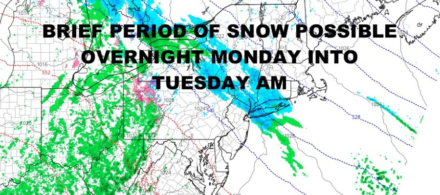
NYC Light Snow Possible Overnight Tomorrow
Good afternoon everyone. We continue to watch a weak system slowly making it’s way towards our area that’ll bring some overrunning-type snow/rain overnight tomorrow into Tuesday morning. Timing will be key as far as seeing any accumulation. Aside from that, we have a fairly quiet week until some rain arrives late in the week.
SATELLITE

Look for blustery and chilly conditions today with highs in the mid 40’s. It’ll be sunny and cold/chily tomorrow under full sunshine. Highs in the 35-40 range.
WEATHER RADAR

Clouds increase overnight tomorrow as lows hover around freezing. We’ll have the chance of some light now and it’ll mostly stick on colder surfaces (cars, branches, and grass). There should be a break Tuesday AM, then precipitation returns as light rain. Highs in the upper 30’s to low 40’s should erase any evidence of snow. Accumulations will range between a trace – 2″, with the upper range more likely well N&W of NYC.

Sunshine returns for Christmas Eve day with mid 40’s, then clouds increase again for Christmas Day. Look for highs in the mid 40’s with the slight chance of some light rain. We’ll have a better chance of rain on Friday under mid 50’s.
BE SURE TO DOWNLOAD THE FREE METEOROLOGIST JOE CIOFFI WEATHER APP &
ANGRY BEN’S FREE WEATHER APP “THE ANGRY WEATHERMAN!
MANY THANKS TO TROPICAL TIDBITS FOR THE USE OF MAPS
Please note that with regards to any severe weather, tropical storms, or hurricanes, should a storm be threatening, please consult your local National Weather Service office or your local government officials about what action you should be taking to protect life and property.