
COUPON CODE SUMMER24 GET 10% OFF
(Tempest is an affilllate of Meteorologist Joe Cioffi & earns commissions on sales.)
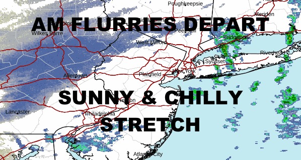
NYC Passing Flurries Give Way to Chilly Sunshine
Good morning everyone. Cold conditions continue as flurries start to make their way east and away from the NYC area. This batch of scattered light flurries and snow showers were expected overnight, but they took a little extra time getting here. Regardless, we have sunshine gradually returning, and it’ll do nothing to help warm us up.
SATELLITE

Temperatures remain below average for the next several days. Highs today will be in the upper 30’s to low 40’s at best, and a carbon-copy day for tomorrow even with the extra sunshine. Lows are also on the cold side as we drop into the upper 20’s to near 30 each night.
WEATHER RADAR

Monday is downright cold with highs near 30; then we’ll have another visit of frigid overnight conditions with lows in the mid to upper teen’s. Tuesday’s not much better, but at least the lows overnight stabilize in the near 30 range.

For midweek, look for increasing clouds with the chance of some cold rain showers Wednesday. Highs should be in the mid 40’s for a more average day.
BE SURE TO DOWNLOAD THE FREE METEOROLOGIST JOE CIOFFI WEATHER APP &
ANGRY BEN’S FREE WEATHER APP “THE ANGRY WEATHERMAN!
MANY THANKS TO TROPICAL TIDBITS FOR THE USE OF MAPS
Please note that with regards to any severe weather, tropical storms, or hurricanes, should a storm be threatening, please consult your local National Weather Service office or your local government officials about what action you should be taking to protect life and property.