
COUPON CODE SUMMER24 GET 10% OFF
(Tempest is an affilllate of Meteorologist Joe Cioffi & earns commissions on sales.)
NYC Showery Day Today Then Much Colder
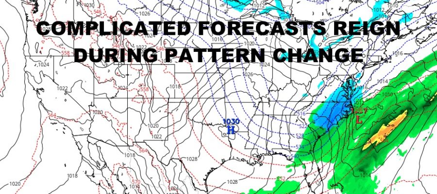
Good morning everyone. We have a complicated forecast coming up as reinforcing shots of cold air swing by and moisture gets hung up in the Southeast and along the Gulf. This is typically how we see some of our storms during the winter, but everything seems to happen “too late” or not at all. The rest of this week into the the weekend will be no different.
SATELLITE

Ahead of our next reinforcing shot of cold air, look for increasing clouds and the chance of some showers today. Highs will be near 50. Showers continue overnight, then as temps drops and moisture gets squeezed out of the atmosphere, we could see some scattered flurries or snow showers tomorrow with temps falling through the 30’s.
WEATHER RADAR

It’ll be a blustery day on Friday with sunshine and highs 30-35 for a very cold feel when factoring in the wind.

Your weekend looks a tad complicated with another reinforcing of cold air swinging by. We’ll have increasing clouds on Saturday with the chance of some cold rain or rain/snow mix. Highs will be in the low 40’s, then drop overnight. Eyes will be on leftover moisture in the Southeast to see if anything tries to come up the coast for Sunday. Either way, it’ll be a cold one with highs in the upper 20’s to low 30’s; then that cold air locks in for next workweek.
BE SURE TO DOWNLOAD THE FREE METEOROLOGIST JOE CIOFFI WEATHER APP &
ANGRY BEN’S FREE WEATHER APP “THE ANGRY WEATHERMAN!
MANY THANKS TO TROPICAL TIDBITS FOR THE USE OF MAPS
Please note that with regards to any severe weather, tropical storms, or hurricanes, should a storm be threatening, please consult your local National Weather Service office or your local government officials about what action you should be taking to protect life and property.