
COUPON CODE SUMMER24 GET 10% OFF
(Tempest is an affilllate of Meteorologist Joe Cioffi & earns commissions on sales.)
NYC Snow Pays a Visit Twice
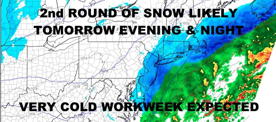
Good afternoon everyone and happy Saturday! We’re watching some light to moderate snow from the NYC area westward and northward as our next reinforcing shot of cold air heads in. Along coastal sections and out on Long Island, it is mostly rain or a mix of rain and snow aside from parts of western Nassau and the north shore. We’re not expecting anything big here, but it’ll be a slushy inconvenience for some; plus a 1-3/2-4″ type snowfall N&W of NYC. We’re also watching our next system hot on the heels of today’s, and we should see another round of snow out of it. Details below….
SATELLITE

For today, look for highs in the low to mid 30’s and light to moderate snow mixing with rain at times. Look for a slushy 1/2-1″ of snow, with not much expected out east.
WEATHER RADAR

Snow returns tomorrow as moisture rides up the coast and a wave of low pressure develops “too late” and too far offshore. However, some of that moisture is trending westward, and we could see some accumulating snow. Look for a 1-3/2-4″+ type snowfall, with the best chance for heavier amounts in parts of Suffolk County.

MLK day looks sunny and cold, with highs in the low to mid 30’s; then we go very cold overnight as we dip into the teens. We’ll barely recover into the low to mid 20’s on Tuesday for highs.
BE SURE TO DOWNLOAD THE FREE METEOROLOGIST JOE CIOFFI WEATHER APP &
ANGRY BEN’S FREE WEATHER APP “THE ANGRY WEATHERMAN!
MANY THANKS TO TROPICAL TIDBITS FOR THE USE OF MAPS
Please note that with regards to any severe weather, tropical storms, or hurricanes, should a storm be threatening, please consult your local National Weather Service office or your local government officials about what action you should be taking to protect life and property.