
COUPON CODE SUMMER24 GET 10% OFF
(Tempest is an affilllate of Meteorologist Joe Cioffi & earns commissions on sales.)
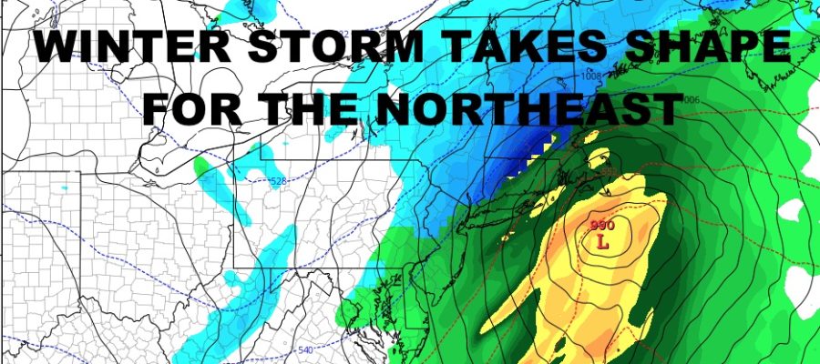
Winter Storm Takes Shape For Northeast
Good morning everyone. Our first winter storm of the season is on its way and we’re watching things closely to see where the final rain/snow line will set up. As for NYC, we’re sitting most of this out aside from a few flakes possible during the onset. It’s still a winter storm for many though, so we’ll go ahead with the forecast.
SATELLITE

Look for a sunny and chilly day today as highs only reach into the low 40’s at best. There will also be some steady northwesterlies to add to the chill. Overnight, clouds increase and temps will drop into the near 30 range.
WEATHER RADAR

That’ll help set the stage for some wet flakes possible before sunrise and into the earliest part of rush hour tomorrow, before changing to a cold rain. Highs will be a miserable and raw low 40’s. We’ll also have some wind to deal with as low pressure deepens offshore. Look for steady 10-20mph winds and some gusts near 30mph; a little amplified at the immediate shore and east end of Long Island.

For those who see all snow, look for 6-12″ of heavy wet snow; specifically interior parts of the Northeast and New England. At this point, I believe areas west and northwest of Boston will see the biggest numbers as they near that 12″ mark.
BE SURE TO DOWNLOAD THE FREE METEOROLOGIST JOE CIOFFI WEATHER APP &
ANGRY BEN’S FREE WEATHER APP “THE ANGRY WEATHERMAN!
MANY THANKS TO TROPICAL TIDBITS FOR THE USE OF MAPS
Please note that with regards to any severe weather, tropical storms, or hurricanes, should a storm be threatening, please consult your local National Weather Service office or your local government officials about what action you should be taking to protect life and property.