
Weather in 5/Joe & Joe Weather Show Latest Podcast
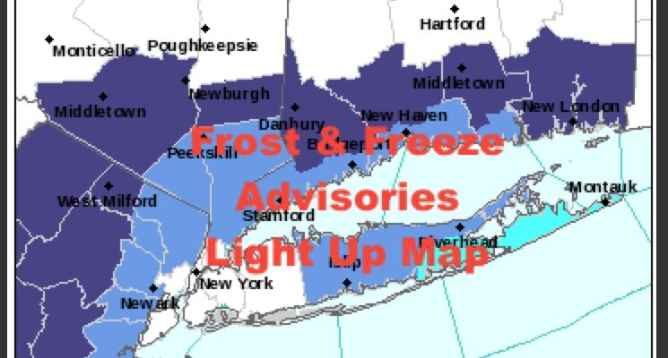
Frost Freeze Advisories Ping Map Mild Air Returns Next Week
Good morning everyone. We’re in the near 40 range in NYC for those waking up early this morning but widespread 30’s can be found away from the City. There are plenty of mid 30’s to be found across Long Island, and lots of low 30’s N&W of NYC. That trend will continue for a few days, and many of us will be experiencing our first frost and freezes. Don’t blink though, because milder air is on the move next week.
SATELLITE

Sunny skies and low 50’s will be the theme for the rest of our workweek, with upper 30’s being felt even in the NYC area overnight tonight through Friday. Again, reports of frost won’t be uncommon, and areas away from the City will experience their first freezes in spots.
WEATHER RADAR

Mid 50’s return for the weekend, but a coastal system scooting out to sea may be close enough to throw back some clouds and wind on Sunday; especially in the afternoon.

We continue to watch next week for the opportunity of some milder air in the area. Sometimes these things don’t work out as clear-cut as you’d like them too, but we are watching. At minimum, upper 50’s to low 60’s return to start next week, and we’ll see how things progress. It all depends on if our warm front can fully clear the area in order for Wed, Thur, and maybe even Friday to be in the mid 60’s and above.
BE SURE TO DOWNLOAD THE FREE METEOROLOGIST JOE CIOFFI WEATHER APP &
ANGRY BEN’S FREE WEATHER APP “THE ANGRY WEATHERMAN!

MANY THANKS TO TROPICAL TIDBITS & F5 WEATHER FOR THE USE OF MAPS
Please note that with regards to any severe weather, tropical storms, or hurricanes, should a storm be threatening, please consult your local National Weather Service office or your local government officials about what action you should be taking to protect life and property.