
COUPON CODE SUMMER24 GET 10% OFF
(Tempest is an affilllate of Meteorologist Joe Cioffi & earns commissions on sales.)
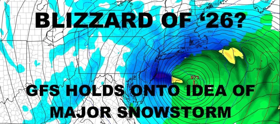
GFS Holds Onto Powerful Snowstorm Sunday & Monday
Good morning everyone. We’re watching a system move through the area bringing a chilly, rainy, and raw day today. Behind it is where the big news is at. There are still a lot of questions to be answered, but things are starting to dial in even though there are some differences between the models.
SATELLITE

For today, look for a cold rain with highs near 40. Tomorrow is possibly the “calm before the storm”, with a mix of sun & clouds and highs in the mid to upper 40’s.
WEATHER RADAR

Clouds increase overnight Saturday into Sunday, with snow developing some time between late morning and mid afternoon. How much snow we get is up in the air, but the GFS is depicting a powerful storm with strong winds as low pressure quickly deepens offshore. The heaviest snow remains in South Jersey, Maryland, Delaware, and possibly clipping the Forks & Cape Cod. If the storm unfolds the way the GFS depicted this morning, it would put someone in line for 25-30″ of snow. Looking at the wind profile, if the storm materialized this way, we would expect blizzard warnings to be posted in certain areas.

While the GFS depicts a powerful snowstorm, the EURO shows us a weaker and faster-moving system. That being said, we are starting to see the EURO drift towards the GFS in terms of proximity and some deepening compared to previous model runs.
Stay tuned, because if the GFS holds onto the idea and things go that route, we’re looking at a historical system for somebody; even if it isn’t for NYC.
BE SURE TO DOWNLOAD THE FREE METEOROLOGIST JOE CIOFFI WEATHER APP &
ANGRY BEN’S FREE WEATHER APP “THE ANGRY WEATHERMAN!
MANY THANKS TO TROPICAL TIDBITS FOR THE USE OF MAPS
Please note that with regards to any severe weather, tropical storms, or hurricanes, should a storm be threatening, please consult your local National Weather Service office or your local government officials about what action you should be taking to protect life and property.