NYC Late Storms Possible Still Watching Hurricane Lee
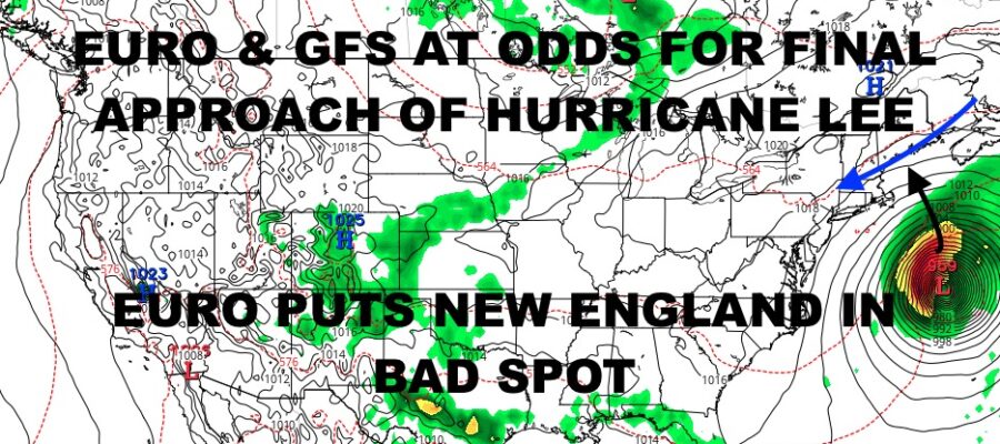
Good morning everyone. We continue to watch Hurricane Lee and the GFS/EURO models disagreeing on the final outcome of this. We also have our front hung up to the west, which will be a player down the road as far as where Hurricane Lee goes.
Lee is holding steady at 115mph winds, and is slowly getting ready for its transition towards the northwest, then north. As of now, it’s still moving WNW, but is slowing down which means the air currents are starting to influence it. We epexct it to move in between Bermuda and the Carolinas, closer to the Bermuda side, then race northward into the New England/Nova Scotia region.
How close it gets to New England will all depend on the timing and positioning of high pressure behind our front that’s off to our west right now. The GFS paints a rosier picture than the Euro, with Hurricane Lee hitting Nova Scotia. While this is the best case scenario, understand that parts of New England will still see tropical storm or near-tropical storm conditions, heavy rain, coastal flooding, high surf, and major beach erosion.
The EURO has a more ominous picture, with Lee taking a dip in close to, but not making landfall at Cape Cod. This scenario could bring hurricane conditions to parts of SE New England, damaging storm surge, and even coastal flooding to parts of Long Island.
We continue to watch the situation and I still believe it’s too early to tell as far as sounding the all-clear, especially for New England.
Check out the local forecast below.
SATELLITE
We have cloudy skies this morning giving way to some sun and humid near 80 temps. that sunshine will help fuel late showers and storms that are expected tonight/overnight. Some of those storms could be on the strong to severe side.
Clouds and showers stick around tomorrow with this slow moving front. We could also have a rumble of thunder here or there. Highs in the mid 70’s.
WEATHER RADAR
Thursday is the best day of the week, with sunshine, a light breeze, and highs int he mid 70’s. For Friday, I’m going to continue to call for AM sun, PM increasing clouds, and a steadier breeze developing.
We’ll continue to hold off on the weekend to see what Hurricane Lee does.
BE SURE TO DOWNLOAD THE FREE METEOROLOGIST JOE CIOFFI WEATHER APP &
ANGRY BEN’S FREE WEATHER APP “THE ANGRY WEATHERMAN!
MANY THANKS TO TROPICAL TIDBITS & F5 WEATHER FOR THE USE OF MAPS
Please note that with regards to any severe weather, tropical storms, or hurricanes, should a storm be threatening, please consult your local National Weather Service office or your local government officials about what action you should be taking to protect life and property.


