NYC Mild Transition Towards Very Warm Week’s End
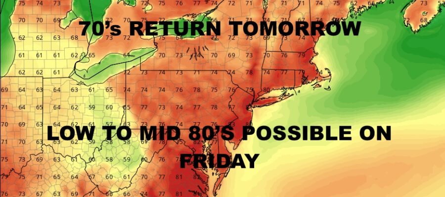
Good morning everyone. We have our transition day today with a weak area of disturbed weather riding near the jet stream, then sunshine returns tomorrow for beautiful day. We will build to a crescendo Friday for the warmest of the bunch, then slowly sink back towards cool as time goes along.
SATELLITE
Expect clouds and sun today with the slight chance of a shower. The header says 70’s return tomorrow even though we’ll call for 65-70 today. The only way we reach 70 today is if we get some extra sunshine and the wind cooperates.
Full sunshine returns tomorrow and low to mid 70’s will be experienced almost everywhere.
WEATHER RADAR
Thursday we go warmer as light westerlies help create the prime ingredients for near 80 temps. Sunshine continues for one more day, and we do 80-85 Friday for a potentially very warm & dry day.
Clouds will mix in with sunshine on Saturday and we will try to remain warm. Right now I’m going conservative with upper 70’s, but we could see some low 80’s IF we can squeeze out some extra sun.
We cool off even more on Sunday with some extra clouds into the mix, and upper 60’s to 70’s for highs.
So far next workweek starts off with clouds, scattered showers, and cooler conditions with mid to upper 60’s. However, mild air is going to try and fight back next week. For the moment, I’m going to hold off and see how it plays out because it looks complicated and very dependent on the cloud and sunshine factor.
BE SURE TO DOWNLOAD THE FREE METEOROLOGIST JOE CIOFFI WEATHER APP &
ANGRY BEN’S FREE WEATHER APP “THE ANGRY WEATHERMAN!
MANY THANKS TO TROPICAL TIDBITS & F5 WEATHER FOR THE USE OF MAPS
Please note that with regards to any severe weather, tropical storms, or hurricanes, should a storm be threatening, please consult your local National Weather Service office or your local government officials about what action you should be taking to protect life and property.


