

COUPON CODE SUMMER24 GET 10% OFF
(Tempest is an affilllate of Meteorologist Joe Cioffi & earns commissions on sales.)
NYC Perfect Friday Ahead
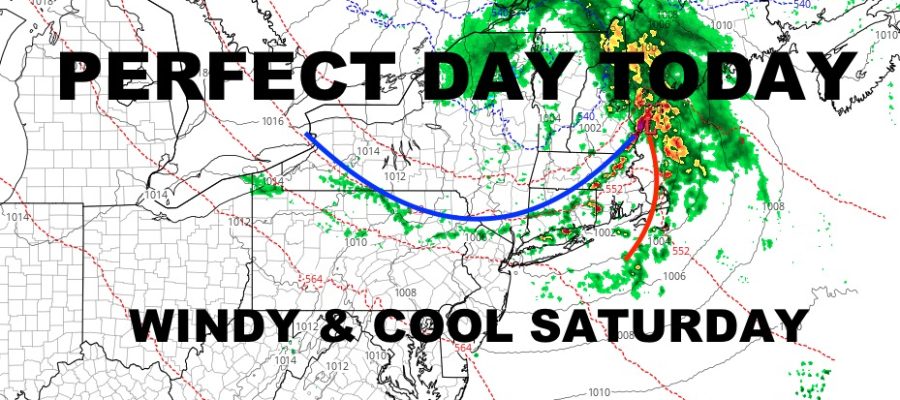
Good morning everyone. We have an absolutely prefect day today ahead of low pressure dropping out of Canada and transiting through New England in a rare late-May north-to-south path. That’ll kick off heavy rain and thunderstorms through parts of our neighbors, plus some windy & cool conditions here tomorrow.
SATELLITE

Look for sunshine today and comfortably warm conditions with highs near 80. Clouds will increase overnight, and we could see a stray shower or storms as the “tail” of compact & vigorous low pressure swoops through. Most of the action will be north of us, but we cannot rule out an isolated storm; especially on the east end of Long Island. Winds will increase as well, with stiff westerlies rotating to NNW winds gusting to 30mph.
WEATHER RADAR

Winds increase even more tomorrow, with NNW winds gusting to near 40mph. It’ll be sunny, but highs only reach the mid to upper 60’s as cooler air gets pumped in. Things calm down on Sunday, with sunny skies, lighter winds, and highs in the 75-80 degree range.
Your workweek is holding steady, with sunshine and highs 75-80º for Monday.
BE SURE TO DOWNLOAD THE FREE METEOROLOGIST JOE CIOFFI WEATHER APP &
ANGRY BEN’S FREE WEATHER APP “THE ANGRY WEATHERMAN!
MANY THANKS TO TROPICAL TIDBITS FOR THE USE OF MAPS
Please note that with regards to any severe weather, tropical storms, or hurricanes, should a storm be threatening, please consult your local National Weather Service office or your local government officials about what action you should be taking to protect life and property.