NYC Rain Heads Into Area Overnight
Good afternoon everyone. Highs pressure is holding on just long enough to squeeze out one more dry day, but rain is knocking on the door just south of the area. Easterly winds have done a good job blowing the smoke and haze back where it came from, and we will get some much needed rain. The bad news? We have an unsettled period building up, with a system-parade pattern for the next 10-14 days.
SATELLITE

Expect increasing clouds today after a fairly sunny start. Temps will be slightly below average, with mid 70’s in most spots aside fromm the immediate shore.
Rain develops overnight, and we’ll have on and off showers all day tomorrow with cool conditions. Highs 65-70.
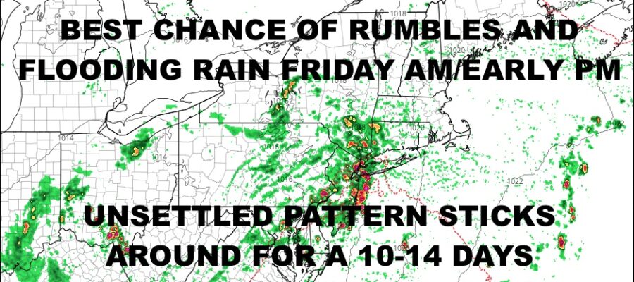
WEATHER RADAR

I think Friday gives us the best chance for some heavy showers and storms, possibly causing local flooding in spots. It’ll be a humid one with highs in the mid to upper 70’s.
Saturday and Sunday both remain cloudy with the chance of showers and rumbles. We remain humid with highs near 80.

BE SURE TO DOWNLOAD THE FREE METEOROLOGIST JOE CIOFFI WEATHER APP &
ANGRY BEN’S FREE WEATHER APP “THE ANGRY WEATHERMAN!
MANY THANKS TO TROPICAL TIDBITS & F5 WEATHER FOR THE USE OF MAPS
Please note that with regards to any severe weather, tropical storms, or hurricanes, should a storm be threatening, please consult your local National Weather Service office or your local government officials about what action you should be taking to protect life and property.