
Weather in 5/Joe & Joe Weather Show Latest Podcast
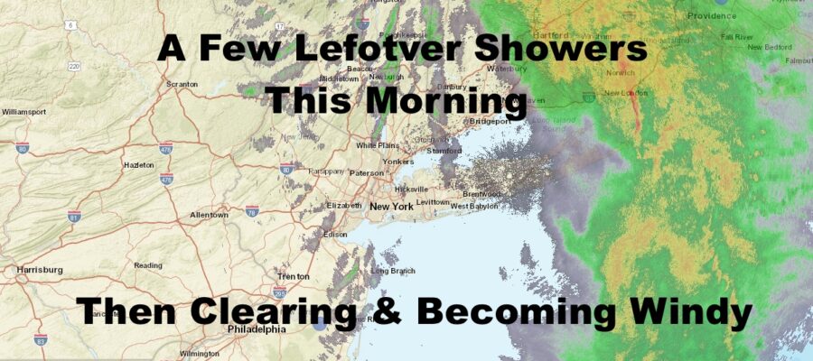
NYC Scattered AM Sprinkles Then Clearing With Wind Picking Up
Good morning everyone. We had some pretty good rain last night that’s finally starting to clear the entire area and move into New England. We still have some clouds and scattered sprinkles around, but those should be on the move too. Our long range continues to look quiet snow-wise, but we are getting a better idea as to how the very cold air may creep into the area late month. Creep is the key word as it’ll happen rather quietly and slowly (if it does happen).
SATELLITE

We pretty much have 1 round left of light showers and sprinkles left with some remaining energy left behind. That’ll probably begin to enter that area as I’m typing, and be with us for an hour or two. Expect partial clearing later in the day, and we may even see a nice sunset. Highs will be in the mid 40’s at best, and increasing wind will help make things feel colder.
Tomorrow is sunny but blustery with highs in the low 40’s.

Low 40’s and breezy conditions continue for Monday. We could see a flurry or two, but I’m keeping the skies mostly sunny and not paying much attention to it. Most of the flurry action (if any), will be concentrated inland.
Tuesday is another sunny day with dry conditions, with wind relaxing a bit. Highs in the upper 30’s to low 40’s.
Wednesday was supposed to be the original day where very cold air made its way in, but that didn’t pan out with no major systems around. However, it will be “colder” with highs in the mid to upper 30’s. That’s actually slightly below average as we enter the “dead of winter”, where the average highs is 39. Wednesday will be another day where we could see a flurry with that reinforcing shot of “cold’ air.
Thursday remains on the colder side, but nothing extreme with more mid to upper 30’s.

In the long range, there continues to be nothing very promising for snow-lovers. Very cold air remains on the move, but it’s a slow creep south and east, and will most likely not be brought in by a big system. If everything works out, it looks as if 40’s slowly descend into the 30’s, then into the 20’s with little fanfare.
Once that cold air is in, our systems start getting suppressed to the south, keeping anything noteworthy storm-wise out of the area. Aside from some flurries, it’s highly possible that our January goes down in the books as snowless.
BE SURE TO DOWNLOAD THE FREE METEOROLOGIST JOE CIOFFI WEATHER APP &
ANGRY BEN’S FREE WEATHER APP “THE ANGRY WEATHERMAN!
MANY THANKS TO TROPICAL TIDBITS FOR THE USE OF MAPS
Please note that with regards to any severe weather, tropical storms, or hurricanes, should a storm be threatening, please consult your local National Weather Service office or your local government officials about what action you should be taking to protect life and property.