NYC Temps Modify After Cool Day Much Needed Rain Monday Night
Good cold morning everyone. Snowy the Frostman paid a visit last night to many parts of our interior neighbors, and we have a cool day in store for the entire region. Temps will modify quickly as we go on, and we’ll also get some much needed rain to start the week.
SATELLITE

The core of that cool air has settle over us, and an easterly fetch will help keep things on the cool side today. The good news is that the wind has settled down, but highs are only going into the near 60 to low 60 realm.
Tomorrow we begin to cloud up as our next system approaches from the west. It won’t be an amazing day, but it won’t be that bad either. Temps quickly recover into the upper 60’s to low 70’s, and we’ll have the slight chance of a shower in the afternoon.
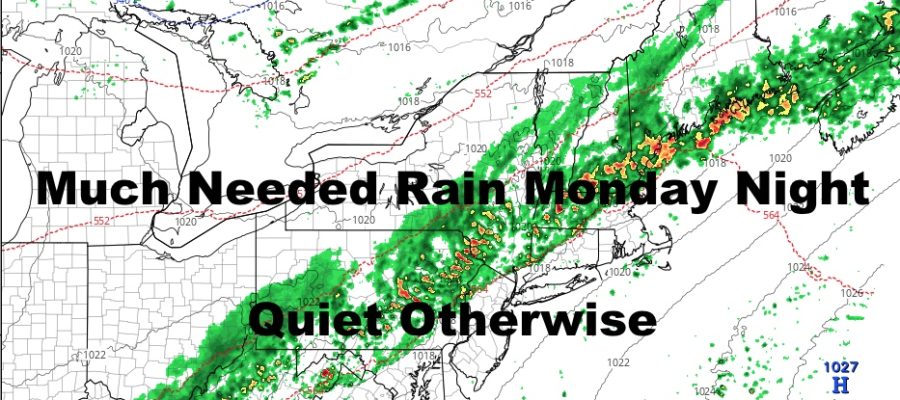
REGIONAL RADAR

On Monday, that front slowly starts to make it our way. To start off, most of the energy will ride up and over the area, going well to our north. However, several waves will ride that boundary as it continues to drift east. Expect the chance of a shower at any time on Monday ahead of the front, then a better chance of some steadier rain overnight Monday. If timed right, we could get a nice soaking, which is much needed. Highs Monday a cloudy and humid 75-80.
LOCAL RADAR NEW YORK CITY

We clear out on Tuesday and probably end the day with a nice sunset. We’ll also sink back down to seasonal temps in the upper 60’s. On Wednesday, I’ll be keeping an eye on some moisture offshore to see if it clips us or not. At this point, Wednesday can go either way, so I’m not going to call the ball on it yet.
LOCAL RADAR PHILADELPHIA


Another large system will approach from our west as we get to the end of the week and the timing right now is suspect. We could get a split weekend with a decent Saturday and a cool Sunday, or something completely different. I’ll be keeping an eye on it all, but we have to see how fast things clear out on Monday night/early Tuesday before we start calling the other systems.
MANY THANKS TO TROPICAL TIDBITS FOR THE USE OF MAPS
Please note that with regards to any tropical storms or hurricanes, should a storm be threatening, please consult your local National Weather Service office or your local government officials about what action you should be taking to protect life and property.