

COUPON CODE SUMMER24 GET 10% OFF
(Tempest is an affilllate of Meteorologist Joe Cioffi & earns commissions on sales.)
NYC Top-Notch Workweek Weather Expected
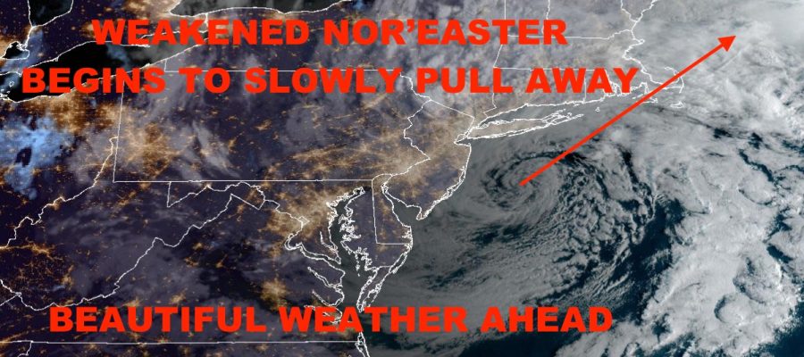
Good morning everyone. Our weakening nor’easter continues to meander just south of Long Island as we speak, with most of the rain shield north and east of the NYC area. We still have some clouds and sprinkles to go, as well as some minor flooding, but we’re almost out of the woods. The payoff comes tomorrow through Friday, with some really spectacular weather expected to end September and start October.
SATELLITE

For today, clouds and scattered showers/sprinkles stick around till late morning/early afternoon. Look for steady northerlies with some gusts approaching the mid 20mph range. Highs will be in the mid 60’s at best.
WEATHER RADAR

Sunshine returns tomorrow under drying conditions and light NW winds. Highs will be in the low 70’s. Wednesday remains sunny and even more mild as mid 70’s grace us. Thursday and Friday look like the mildest/warmest of the bunch, with more sunshine and highs in the upper 70’s to near 80º.
We go a little bit cooler (but still mild) on Saturday with clouds starting to creep in ahead of our next system. Highs will be in the near 70/low 70 range; then clouds and the chance of some scattered showers Sunday as we sink into the 60’s.
BE SURE TO DOWNLOAD THE FREE METEOROLOGIST JOE CIOFFI WEATHER APP &
ANGRY BEN’S FREE WEATHER APP “THE ANGRY WEATHERMAN!
MANY THANKS TO TROPICAL TIDBITS FOR THE USE OF MAPS
Please note that with regards to any severe weather, tropical storms, or hurricanes, should a storm be threatening, please consult your local National Weather Service office or your local government officials about what action you should be taking to protect life and property.