

COUPON CODE SUMMER24 GET 10% OFF
(Tempest is an affilllate of Meteorologist Joe Cioffi & earns commissions on sales.)
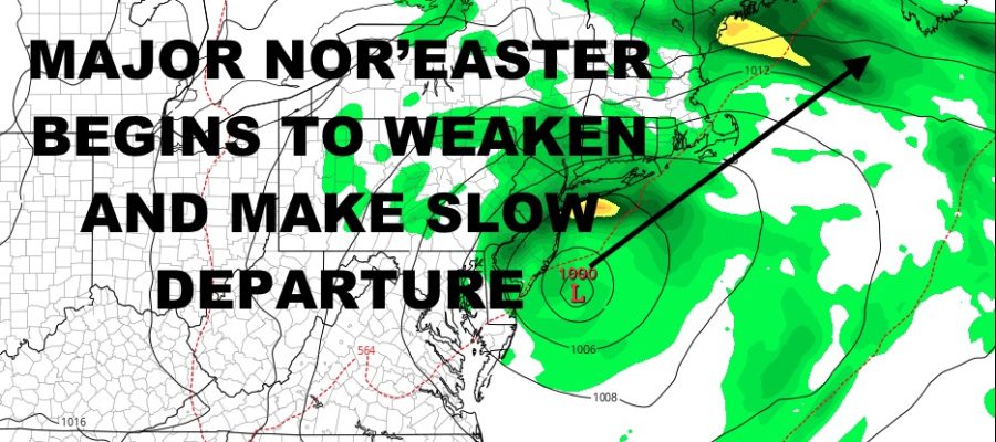
Nor’easter Begins to Pull Away From NYC Area
Good morning everyone. Our powerful early-season nor’easter is beginning to weaken as it continues to drift slowly to the east, then eventually southwest, south, then off to the northeast and out of the picture. This will be a slow process, but thankfully thinks are starting to dwindle down as far as strong winds and flood tides. After we get through this, the cleanup will begin in areas impacted the most, and it’ll be under some beautiful fall conditions.
SATELLITE

Areas his hardest with flooding, include the south shore of Long Island; most notably Freeport, Long Beach, and Lindenhurst. This is where some of the worst flooding occurred, and homes will have to be repaired. We also saw some major flooding along the Jersey Shore, including parts of Cape May, NJ. While flooding was not life threatening or anything on the level of Sandy or even Irene, cleanup will take a while.
Wind gusts were on the “typical” side of a powerful nor’easter as well. Montauk is the big winner, with a reported wind gust of 81mph. Aside from a few lollipop reports, though, wind gusts peaked at a general 45-55mph. Sustained winds were also of the non-hurricane realm, with average numbers in the 30-40mph range at the peak of our nor’easter.
For today, we’ll see the risk of rain subside, then increase again as our system begins to pivot and make the turn to leave the region. Again, this will be a slow process, so expect some blustery conditions and gusty showers/periods of rain through tomorrow. As far as flooding, look for moderate flooding to subside to minor flooding over the next couple of cycles, then no flooding of consequence likely by tomorrow.
Highs today will remain in the mid 60’s, then mid to upper 60’s tomorrow.
WEATHER RADAR

By Tuesday, things start to improve as sunshine and near/low 70º temps return. Look for more sunshine and mid to upper 70’s Wednesday through Friday. Your weekend starts off dry and somewhat seasonable, with slightly cooler conditions in the 65-70º realm.
BE SURE TO DOWNLOAD THE FREE METEOROLOGIST JOE CIOFFI WEATHER APP &
ANGRY BEN’S FREE WEATHER APP “THE ANGRY WEATHERMAN!
MANY THANKS TO TROPICAL TIDBITS FOR THE USE OF MAPS
Please note that with regards to any severe weather, tropical storms, or hurricanes, should a storm be threatening, please consult your local National Weather Service office or your local government officials about what action you should be taking to protect life and property.