

COUPON CODE SUMMER24 GET 10% OFF
(Tempest is an affilllate of Meteorologist Joe Cioffi & earns commissions on sales.)
NYC & Long Island Flooding Concerns Increase
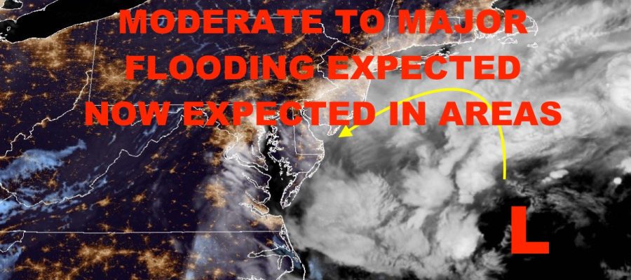
Good morning everyone. As we watch our coastal storm unfold and path start to solidify, our concerns for flooding across parts of NYC, Long Island, and New Jersey Increase. This will be strictly coastal flooding, not rain flooding as rain amounts will be spread out of the course of days and not hours. With the angle the storm will be approaching and retrograding, it will be bringing a lot of water with it. That being said, this is not a Hurricane Sandy-type situation. It’s one of those things where if you get flooding during a moderate to bad Nor’Easter, expect flooding during this one.
SATELLITE

Look for increasing clouds today with the risk of some showers developing. Winds will also increase, with NE wind gusts increasing to 25-35 mph (strongest winds along the coast). Further out east, wind gusts will increase into the 35-45 mph range. We’ll have steady rain overnight, just like Nor’Easters of the past, with strong wind gusts reaching 40-50mph (again, strongest along the coast). As you get out to the Forks of Long Island, wind gusts will peak at 55-65mph.
WEATHER RADAR

Look for more of the same tomorrow and Sunday as our system backs up towards Jersey and down into the Mid-Atlantic. It’ll make a loop, then finally depart later on Monday. As far as flooding is concerned, look for moderate flooding possible in areas such as Long Beach, Lido Beach, and Point Lookout. As you get into the back bays, major flooding is possible as that water piles in. Your best chance to see major flooding will be parts of Far Rockaway and Broad Channel in Jamaica Bay; then Freeport, Baldwin, Lindenhurst, and other flood prone spots along the south shore/Great South Bay. Move cars and valuables away from flood-prone areas, as well as out of basements susceptible to flooding. In some cases, we’re expected 3-4 ft of inundation above sea level.
We haven’t had a good Nor’Easter in a while, so the sight of coastal flooding from one and what it entails, will be surprising to some.
Sunshine should be slow to return, but we don’t get into it on Tuesday with cool conditions in the mid 60’s.
STAY SAFE EVERYONE!
BE SURE TO DOWNLOAD THE FREE METEOROLOGIST JOE CIOFFI WEATHER APP &
ANGRY BEN’S FREE WEATHER APP “THE ANGRY WEATHERMAN!
MANY THANKS TO TROPICAL TIDBITS FOR THE USE OF MAPS
Please note that with regards to any severe weather, tropical storms, or hurricanes, should a storm be threatening, please consult your local National Weather Service office or your local government officials about what action you should be taking to protect life and property.