
COUPON CODE SUMMER24 GET 10% OFF
(Tempest is an affillate of Meteorologist Joe Cioffi & earns commissions on sales.)
Stubborn Low Pressure Keeps Clouds Around
09/18/24 9:05am ET
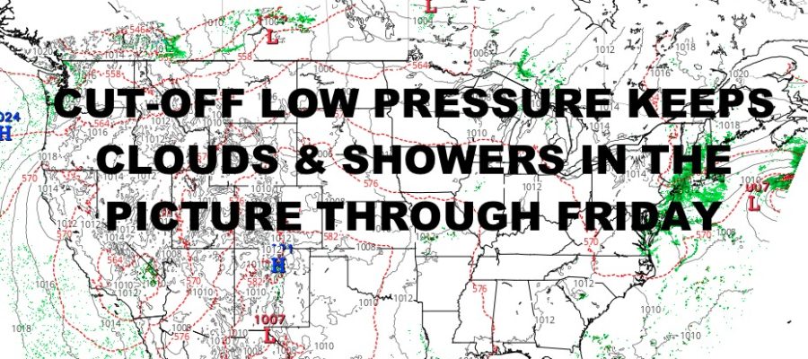
Good morning everyone. Our low pressure that brought heavy rain and strong winds to North Carolina & South Carolina, has parked itself in the Mid-Atlantic with nowhere to go for another few days. This will impact the forecast for the Northeast as we extend clouds and showers across the region into Friday.
In southeast New England, parts of Connecticut, Rhode Island, and the Cape Cod area of Massachusetts, could see some heavy showers and thunderstorms tomorrow as low pressure sends another spoke of energy from off of the ocean. We could also see some of that action clip eastern Long Island. Gusty winds and localized flooding in poor drainage areas will be the biggest hazards.
It also impacts the Mid-Atlantic, with coastal flooding issues for Virgina, Maryland, and Delaware due to the prolonged fetch of onshore winds that’ll help pile up the water. We are also seeing scattered gusty heavy showers and thunderstorms scattered about the region, with some localized rain flooding possible. Expect those tropical showers and rumbles to continue throughout the day.
In the Midwest, the severe weather se saw last night, will once again flare up this afternoon and evening. For the moment, some leftover heavy showers and thunderstorms stretch from central/eastern North Dakota, South Dakota, Nebraska, and down into Kansas. While we don’t have any severe weather at this time, expect to see heavier storms tonight. The primary risk will be similar to last night, with very large hail, damaging winds, frequent lightning, torrential rain, and the chance of a few tornadoes.
Here is your local NYC Metro forecast –
SATELLITE

Look for mostly cloudy skies with scattered showers and possibly a rumble of thunder today through Friday. We could also see some heavier rain the further east you go on Long Island. Highs will be in the low to mid 70’s each day, cooler at the immediate shore and east end.
WEATHER RADAR

Things begin to clear out on Saturday, with a mix of sun & clouds and mid 70’s. Sunday we go full-sunshine, with low 70’s for highs.

Upper 60’s tools 70’s with full sunshine rule the roost Monday through Wednesday for a pleasant first week of fall.
BE SURE TO DOWNLOAD THE FREE METEOROLOGIST JOE CIOFFI WEATHER APP &
ANGRY BEN’S FREE WEATHER APP “THE ANGRY WEATHERMAN!
MANY THANKS TO TROPICAL TIDBITS FOR THE USE OF MAPS
Please note that with regards to any severe weather, tropical storms, or hurricanes, should a storm be threatening, please consult your local National Weather Service office or your local government officials about what action you should be taking to protect life and property.