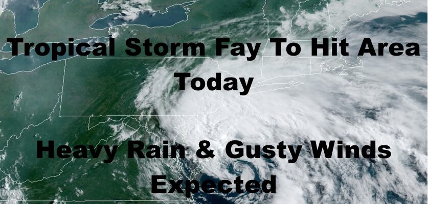
Tropical Storm Fay Hits NYC Area Today
Good morning everyone. Tropical Storm Fay is starting its final approach into the Northeast, and the NYC Metro Area should start feeling its effects soon. As stated yesterday, regardless of what form or title low pressure took when it hit us, it’s pretty much all semantics and just makes for good headlines. However, some areas will see an impact in terms of flooding rains, and I’ll go over it again today.
SATELLITE

For today, rain and gusty winds should start heading in over the course of the next couple of hours. Rain will start off light and quickly go moderate to heavy. Winds will be gusty as Fay has 50mph sustained winds. However, the strongest winds will be felt along the immediate shore and/or during the heaviest precip. Think of this as a Nor’easter or a complex of strong to severe storms coming up from the south; nothing more, nothing less.
The banding is not really set up for maximized water spout observation, but there could be a few brief ones or brief, weak tornados. I’m talking very weak, and very brief.
Our biggest concern is the rain, especially for areas of NJ and Eastern PA. That is where the heaviest rain will concentrate. We’ve seen how NW NJ geography handles these types of systems and it isn’t too pretty, so this is where I’ll be looking for the biggest issues to happen.
Locally, we’ll see some flooding in poor drainage areas; again, much like a Nor’easter or a nocturnal Mesoscale Convective System (MSC).
REGIONAL RADAR

Things will begin to clear out tomorrow, but we’ll have a chance of a storm with that front hanging to our west. It’ll be hot and humid with highs near 90.
Expect a repeat on Sunday with clouds and sun, the slight chance of a storm, and highs near 90.
LOCAL RADAR NEW YORK CITY

Near 90 to 90’s dominate all week next week, with the slight chance of a storm each day. Thursday continues to be the day where we look to bump up the temps and approach the beginning of a heatwave or near-heatwave conditions.
There could be a brief break in the heat that following week, but it looks to snap back quickly; either constituting a brief heatwave and then a longer one, or one big bracket of 95-100 degree weather.
Stay tuned on that.
LOCAL RADAR PHILADELPHIA


MANY THANKS TO TROPICAL TIDBITS FOR THE USE OF MAPS
Please note that with regards to any tropical storms or hurricanes, should a storm be threatening, please consult your local National Weather Service office or your local government officials about what action you should be taking to protect life and property.