Typical NYC Summer Continues
Good morning everyone. We have a nice, hot summer day brewing to end the weekend; but for those interested, you can find some slight relief at the beaches. We might not be as dry as we once thought, with the slight chance of storms each day, but that’s your typical NYC summer, and I’ll explain below.
SATELLITE

Today will be very warm to hot in spots, with highs in the upper 80’s to low 90’s in most areas. With a southwest breeze developing, humidity will increase, but we’ll also be slightly cooler at the shore with some mid to upper 80’s.
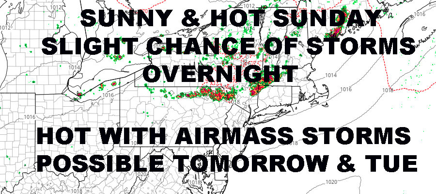
During the late evening, a weak area of energy will spark off some thunderstorms upstate and drift southeast. We’ll have to see if those survive or not, but we will keep the slight chance of storms in the forecast overnight. The best chance to see some heavy, organized action, will be essentially the Catskills to Poughkeepsie on north.
REGIONAL RADAR

Tomorrow, we resume the hot and humid weather. We’ll have highs again in the upper 80’s to low 90’s again (cooler at the shore), and the slight chance of an airmass (popcorn) thunderstorm popping up in the afternoon/evening. These are very hard to predict, so just keep an eye to the sky and watch for some building clouds.
The same goes for Tuesday, with upper 80’s to low 90’s, humid, and the slight chance of an afternoon or evening storm.
LOCAL RADAR NEW YORK CITY

For Wednesday, we’ll increase the chance of storms and 90’s are off the table, but it’ll still be warm and humid with mid to upper 80’s possible. As far as storms are concerned, a slow moving front will help increase the chance, but we still have to wait and see how much energy is available, where it goes, and the timing of precipitation.
Thursday, we’ll keep the chance of showers and storms around as energy is slow to head out. We remain humid and average temp-wise, with mid 80’s.
LOCAL RADAR PHILADELPHIA


As of now, Friday has the best chance to be a dry and sunny day with mid 80’s, before we start introducing more moisture into the area for the weekend. I don’t think we’re looking at any washouts, but we could see numerous pop-up showers and storms Saturday and Sunday afternoon, especially away from the coast.
MANY THANKS TO TROPICAL TIDBITS FOR THE USE OF MAPS
Please note that with regards to any tropical storms or hurricanes, should a storm be threatening, please consult your local National Weather Service office or your local government officials about what action you should be taking to protect life and property.