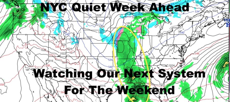
Watching NYC Weekend After Quiet Week
Good morning everyone. We have a very quiet week ahead with nothing very extreme the next few days in terms of cold air. Even if we’re below average the next two days, it’s seasonal and typical for this time of year. It’ll be a very dry 5 days, then we watch our next system as it emerges from the lower Midwest.
SATELLITE

Look for sunny skies today, dry conditions, and a steady NW wind. Highs will be a cold upper 30’s to low 30’s. We dip into the low 20’s overnight, and teens will dot the areas N&W of NYC and parts of Long Island.
REGIONAL RADAR

Cold conditions continue tomorrow with sunny skies and highs in the low 30’s. Winds will subside, so it’ll feel a little bit more tolerable. Lows again will dip into the low 20’s and some teens away from NYC proper.
On Wednesday, we modify a bit and will get near 40 with sunny skies. Look for 20’s again as lows, but now areas away from NYC should be in the 20’s as well with the cold air beginning to modify.
LOCAL RADAR NEW YORK CITY

Thursday we should break 40 with more sun than clouds, then clouds will begin to increase on Friday after some AM sunshine. Look for mid 40’s Friday, then the fun begins for our weekend.
LOCAL RADAR PHILADELPHIA


A weak area of disturbed weather will emerge from the lower rockies and into the lower Midwest. There are a lot of questions as to the placement of all of our features on the map, but we do know that this system will pick up some moisture and march eastward.
Some models are calling for a snowstorm in the Mid-Atlantic and Northeast, others have low pressure going to our north & west or hugging very close or over the NYC Metro Area. There’s also a lot of different ideas as to the strength of low pressure. At this point, it is too early to tell and to say otherwise is just nonsense right now. We are leaning towards a rainy time here in the NYC area, but it could change if the ingredients come together.
We’ll be watching this very closely and will make adjustments as needed.
MANY THANKS TO TROPICAL TIDBITS FOR THE USE OF MAPS
Please note that with regards to any tropical storms or hurricanes, should a storm be threatening, please consult your local National Weather Service office or your local government officials about what action you should be taking to protect life and property.