WINTRY MIX PRECEDES NYC JANUARY THAW
WINTRY MIX PRECEDES NYC JANUARY THAW
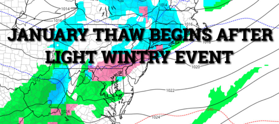
WINTRY MIX PRECEDES NYC JANUARY THAW – Good morning everyone! Relief is here for those who have had enough of the arctic tundra, but we’ll have to get past one more poke in the eye before Mother Nature gives us a break.
High, thin clouds will begin to creep in this morning, then lower and thicken as the day goes on. A broad, but weak system will slide our way, and the majority of the enenrgy will go to our south. We’ll have the slight chance of some light snow, sleet, and freezing rain by late afternoon/early evening. Highs today will be near freezing, so things could get a little tricky with the evening commute.
The chance of a mix will continue through the night, then possibly end as a brief period of all light snow. As far as accumulations, we may see a coating to a half inch total for the entire event. Again, use caution if you’re driving, because even a light mix as temps hover around freezing, can cause a lot of problems.
Tomorrow, the thaw begins. Sunny and breezy conditions will filter in behind tonight’s system, but we’ll reach near 40 as opposed to the teens we’ve been having. Wednesday we dip a little bit, with highs in the upper 30’s, but we bounce back with mid to upper 40’s Thursday.
As our next frontal system goes well to our north, we could see 50-55 Friday and the chance of some rain. This will help melt some of the snow we have on the ground, but it’ll also make things sloppy as far as localized flooding when you combine the rain and melting snow.
The weekend as of now is looking like a split, with mid to upper 40’s for Saturday and partial clearing, then back into the 30’s we go for Sunday.
Arctic air seems allusive next week and we should be in the normal to slightly above normal realm temperature-wise. However, system path could give us a few big boosts and a few dips during this pattern change. Experiencing a day or two of 50-55° or even beyond, wouldn’t surprise me during this 2-3 week period.
NATIONAL WEATHER SERVICE SNOW FORECASTS
LATEST JOESTRADAMUS ON THE LONG RANGE
GET ANGRY BEN A NICE CIGAR!
Weather App
Don’t be without Meteorologist Joe Cioffi’s weather app. It is really a meteorologist app because you get my forecasts and my analysis and not some automated computer generated forecast based on the GFS model. This is why your app forecast changes every 6 hours. It is model driven with no human input at all. It gives you an icon, a temperature and no insight whatsoever.
It is a complete weather app to suit your forecast needs. All the weather information you need is right on your phone. Android or I-phone, use it to keep track of all the latest weather information and forecasts. This weather app is also free of advertising so you don’t have to worry about security issues with your device. An accurate forecast and no worries that your device is being compromised.
Use it in conjunction with my website and my facebook and twitter and you have complete weather coverage of all the latest weather and the long range outlook. The website has been redone and upgraded. Its easy to use and everything is archived so you can see how well Joe does or doesn’t do when it comes to forecasts and outlooks.
Just click on the google play button or the apple store button on the sidebar for my app which is on My Weather Concierge. Download the app for free. Subscribe to my forecasts on an ad free environment for just 99 cents a month.
Get my forecasts in the palm of your hand for less than the cost of a cup of Joe!


