BELOW NORMAL TEMPS HEADING TOWARDS NYC
BELOW NORMAL TEMPS HEADING TOWARDS NYC
BELOW NORMAL TEMPS HEADING TOWARDS NYC – Good morning everyone. Cool air has returned temporarily for today, with sunny skies and a somewhat damp maritime breeze. The sun will help counteract that feel a bit, and we’ll reach our normal mid to upper 50’s.
Tonight, clouds return and we’ll have the slight chance of some drizzle late at night/by daybreak. This is due to another short-lived and front-related area of warmer air moving our way. We’ll hit the low to mid 60’s tomorrow, but with cloudy skies, widely scattered showers/drizzle, today’s 50’s will feel warmer.
That warm air settles over the area for Monday, but because it’s front-related and this airmass is moving fast, we won’t see much sun. Expect highs 65-70 Monday, maybe a touch higher if the sun peaks out, and a decent shot at some afternoon showers with the cold front passing through.
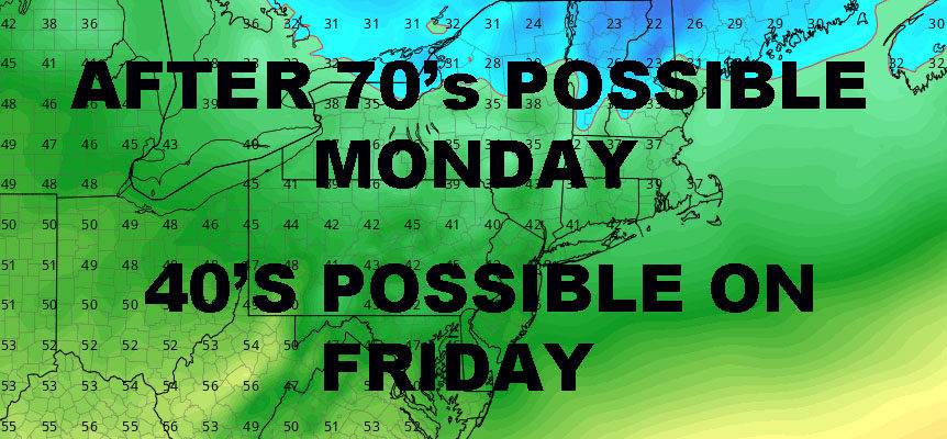
The big story will be Tuesday and beyond. Much cooler air is heading in and we’ll find ourselves near normal at the start, then below normal by late week. In fact, we may not break out of the 40’s as highs on Friday next week. It looks like we modify a bit and back to near-normal by next weekend, but it’s possible a reinforcing shot of much cooler air returns the week of the 13th.
Beyond that, I see the prospect of November’s version of “arctic air” spilling into the upper midwest, with relatively frigid air heading towards or just north of the Chicago area. This could be setting the Great Lakes up for their first true Lake Effect snows mid to late November, and could give us a nice chill here depending on how that cold air transfers to the east. This time of year, cold air masses still modify fairly quickly, so we’ll have to see how it pans out. As of now, the jet stream also remains unfavorable for any powerful systems or system paths that’ll give us prolonged below normal temps.
NATIONAL WEATHER SERVICE SNOW FORECASTS
LATEST JOESTRADAMUS ON THE LONG RANGE
Weather App
Don’t be without Meteorologist Joe Cioffi’s weather app. It is really a meteorologist app because you get my forecasts and my analysis and not some automated computer generated forecast based on the GFS model. This is why your app forecast changes every 6 hours. It is model driven with no human input at all. It gives you an icon, a temperature and no insight whatsoever.
It is a complete weather app to suit your forecast needs. All the weather information you need is right on your phone. Android or I-phone, use it to keep track of all the latest weather information and forecasts. This weather app is also free of advertising so you don’t have to worry about security issues with your device. An accurate forecast and no worries that your device is being compromised.
Use it in conjunction with my website and my facebook and twitter and you have complete weather coverage of all the latest weather and the long range outlook. The website has been redone and upgraded. Its easy to use and everything is archived so you can see how well Joe does or doesn’t do when it comes to forecasts and outlooks.
Just click on the google play button or the apple store button on the sidebar for my app which is on My Weather Concierge. Download the app for free. Subscribe to my forecasts on an ad free environment for just 99 cents a month.
Get my forecasts in the palm of your hand for less than the cost of a cup of Joe!


