WINTERLIKE AIRMASS ARRIVES LATE WEEK

WINTERLIKE AIRMASS ARRIVES LATE WEEK
WINTERLIKE AIRMASS ARRIVES LATE WEEK – Good evening folks. I guess the meatballs cooked all day were for good purpose and will make for some good comfort food this week. Cool air is about to head into the area, then backed up by a reinforcing shot of unseasonably cold air for this time of year.
First, clouds and sprinkles remain over the area as the majority of the energy goes well to our north this evening. Things will clear out later tonight and lows will drop into the upper 30’s/low 40’s. For tomorrow, clouds return as we find ourselves on the maritime side of things. We’ll have a slight chance of showers, northeast winds, and a pretty damp feel in the low 50’s.
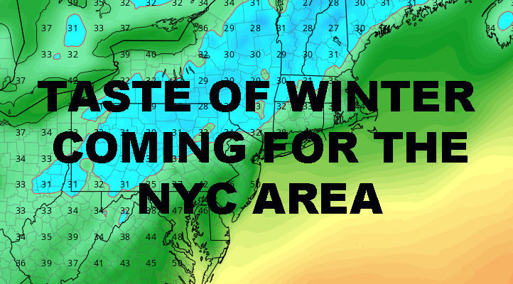
The core of the cool airmass moves over us on Wednesday, giving us another slight chance of showers, clouds and sun, highs in the upper 40’s. We warm up to the mid 50’s for one day on Thursday, then the bottom drops out as this unseasonably cold air rushes in. Friday will be sunny, with highs only in the low to mid 40’s. Low’s Friday night will put the end to any pollen-related allergies, with temps going well below freezing; lows in the mid to upper 20’s, and we could see some low 20’s or even teens in outlying areas, especially the pine barrens and well north and west of NYC.
Saturday, we remain in the big chill, with highs in the low 40’s, but not dropping much overnight with the help of some clouds and an approaching frontal system. Sunday, we may start of with the slight chance of some wet snowflakes mixed in with scattered showers, but it’s due to cold air aloft and will not stick. Whatever wet flakes do mix in, will quickly turn to all rain as we keep showers and low to mid 50’s around for Sunday and Monday.
In the long range, warmer air tries to build back in, but colder air continues to pool up in Canada. This may settle stage for something more robust system-wise, but the way things are going, the action might be well to our north again depending on the final outcome. Either way, this week will show us that the cold air is available and it won’t take much to remind us winter is coming, all we need is the mechanics to make it happen.


NATIONAL WEATHER SERVICE SNOW FORECASTS
LATEST JOESTRADAMUS ON THE LONG RANGE
Weather App

Don’t be without Meteorologist Joe Cioffi’s weather app. It is really a meteorologist app because you get my forecasts and my analysis and not some automated computer generated forecast based on the GFS model. This is why your app forecast changes every 6 hours. It is model driven with no human input at all. It gives you an icon, a temperature and no insight whatsoever.
It is a complete weather app to suit your forecast needs. All the weather information you need is right on your phone. Android or I-phone, use it to keep track of all the latest weather information and forecasts. This weather app is also free of advertising so you don’t have to worry about security issues with your device. An accurate forecast and no worries that your device is being compromised.
Use it in conjunction with my website and my facebook and twitter and you have complete weather coverage of all the latest weather and the long range outlook. The website has been redone and upgraded. Its easy to use and everything is archived so you can see how well Joe does or doesn’t do when it comes to forecasts and outlooks.
Just click on the google play button or the apple store button on the sidebar for my app which is on My Weather Concierge. Download the app for free. Subscribe to my forecasts on an ad free environment for just 99 cents a month.
Get my forecasts in the palm of your hand for less than the cost of a cup of Joe!