COOL NYC WEEKEND ARRIVES WARM WEEK AHEAD

COOL NYC WEEKEND ARRIVES WARM WEEK AHEAD
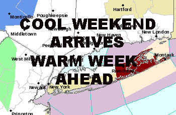
COOL NYC WEEKEND ARRIVES WARM WEEK AHEAD – Good afternoon everyone. The cool air has arrived and with the help of a departing upper level low, some gusty showers and isolated storms have popped up. These showers are similar to what you’d see in the winter when the upper level low of a snowstorm departs, just replace snow squalls with rain showers and maybe some very small hail. Anything that does form, will die off well before sunset.
Highs today will only reach the mid 60’s as the core of the cool air sits over us, then we modify a little bit tomorrow with highs near 70 and sunny skies. Mid 70’s and above normal temps arrive on Monday, then we’re back near 80 midweek and possibly into the weekend. As far as how warm we get, everything hangs on weather the maritime influence pushes back or not.
What we can say now is before the real, longer lasting cool push arrives somewhere between Oct 10-12th, we will see temps 75-80 at minimum, and an uptick in humidity as that front nears the area. If the maritime air holds back, we could see some low to mid 80’s in the warmest of spots before we cool off dramatically.
In the very long range, warm air tries to build into the Midwest once again, but how far north it goes and how or if it transfers to the East coast is not decipherable as of now. We could be looking at another shot of above normal temps again for part of the last 1/3 of October, but as of now it’s just a chance and not written in stone by any means.


NATIONAL WEATHER SERVICE SNOW FORECASTS
LATEST JOESTRADAMUS ON THE LONG RANGE
Weather App

Don’t be without Meteorologist Joe Cioffi’s weather app. It is really a meteorologist app because you get my forecasts and my analysis and not some automated computer generated forecast based on the GFS model. This is why your app forecast changes every 6 hours. It is model driven with no human input at all. It gives you an icon, a temperature and no insight whatsoever.
It is a complete weather app to suit your forecast needs. All the weather information you need is right on your phone. Android or I-phone, use it to keep track of all the latest weather information and forecasts. This weather app is also free of advertising so you don’t have to worry about security issues with your device. An accurate forecast and no worries that your device is being compromised.
Use it in conjunction with my website and my facebook and twitter and you have complete weather coverage of all the latest weather and the long range outlook. The website has been redone and upgraded. Its easy to use and everything is archived so you can see how well Joe does or doesn’t do when it comes to forecasts and outlooks.
Just click on the google play button or the apple store button on the sidebar for my app which is on My Weather Concierge. Download the app for free. Subscribe to my forecasts on an ad free environment for just 99 cents a month.
Get my forecasts in the palm of your hand for less than the cost of a cup of Joe!