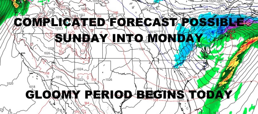
Gloomy Week & Weekend Ahead
Good morning everyone and welcome to the gloomy portion of our programming. Our daisy-chain system has arrived, and with each pass, a new low pressure will form at the trailing end of our front. This will keep clouds and on & off rain in the picture for the next seven days. It could also end on a “different” note, as the last pass of this system Sunday/Monday could have a colder solution to it.
To start off, winter weather advisories are posted throughout the Great Lake States and the Northeast into New England as overrunning moisture meets our departing arctic air. This will touch off light snow, mix, and freezing rain into interior sections of the Northeast and New England. After that, this is mostly a rain event, especially Thursday and Friday as milder air reaches well-north.
Saturday looks like the “nicest” day of the bunch as we pause and could see a few blue patches before rain returns Saturday night. We’ll be watching that last segment closely as models hint that low pressure wants to hook up with cold high pressure to our north. As of now it’s too early in the game, but models this morning show a slower moving system with some re-development offshore, and possibly a rain changing to snow and/or mix event.
Stayed tuned and enjoy the gloom; here is your local forecast –
SATELLITE

Clouds are here to stay for today and it’s going to be a cold and raw one. Light rain expected later today could start off as some ice pellets or graupel, but this will be primarily a cold-rain-event. Highs today in the upper 30’s. Cold rain continues tonight, and we could see a few wet flakes or sleet mixed in at times. No icing or accumulation is expected with lows staying above freezing.
WEATHER RADAR

On and off cold rain continues on Wednesday with highs a raw near 40 degrees. Thursday looks rainy as well, but highs will creep up to near 50. Look for more on and off rain on Friday, especially in the morning, and mid 50’s are possible.

Saturday has the best chance to see a few breaks of sunshine, but rain returns overnight. Highs in the near 50 range. I’m going to hold off on Sunday and Monday for now, but at minimum, we’re probably looking at a rainy Sunday with temps dropping.
BE SURE TO DOWNLOAD THE FREE METEOROLOGIST JOE CIOFFI WEATHER APP &
ANGRY BEN’S FREE WEATHER APP “THE ANGRY WEATHERMAN!
MANY THANKS TO TROPICAL TIDBITS & F5 WEATHER FOR THE USE OF MAPS
Please note that with regards to any severe weather, tropical storms, or hurricanes, should a storm be threatening, please consult your local National Weather Service office or your local government officials about what action you should be taking to protect life and property.