Long Range Forecast Lacks Organized Storms & Measurable Snow
Good morning everyone and welcome to a “snowless” forecast, especially for parts of the NYC Metro Area. We have our system today that’ll give interior sections of the Northeast and New England (especially higher elevations) a period of light to moderate snowfall; but for coastal sections, a parting shot of light snow or mix will be the best we can do. It won’t even stick or freeze as temps stay above freezing and any frozen precip falls on wet grounds.
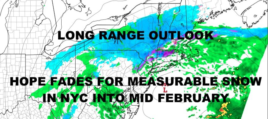
As far as the long range, we are lacking any major organized systems aside from what’s been hitting the west coast. In this 2-3 week stretch, it looks as if our parade of coastal system fall apart as they enter the Rockies and don’t recover well enough to make any type of large impact. Meanwhile, there are also no major pushes of arctic air, keeping much of the lower 48 near-average to above average temp-wise.
The best chance to see any organized rain throughout the period, will be along the Gulf Coast and Southeast, but we are not looking at any widespread severe weather.
Here is your local forecast –
SATELLITE

Clouds and showers stick around today and it’s going to be a raw one. Highs near 40 have already reached their peak, then we drop into the mid 30’s overnight. That’ll help give us a light mix or snow, but no accumulation is expected.
WEATHER RADAR

AM light mix or snow changes back to rain tomorrow before ending. We’ll have partial clearing late with highs near 40 or low 40’s depending on if there are any blue breaks.
Tuesday is partly sunny and seasonably cold, with highs in the mid to upper 30’s.

Chilly conditions continue with near 40 temps Wednesday, then we modify with mid 40’s on Thursday under sun and clouds both days. Look for some early rain and possible parting mix on Friday as a brief hit of very cold air comes in next weekend. However, this is a Northeast/New England problem as far as cold air and the air is shallow and short-lived.
BE SURE TO DOWNLOAD THE FREE METEOROLOGIST JOE CIOFFI WEATHER APP &
ANGRY BEN’S FREE WEATHER APP “THE ANGRY WEATHERMAN!
MANY THANKS TO TROPICAL TIDBITS & F5 WEATHER FOR THE USE OF MAPS
Please note that with regards to any severe weather, tropical storms, or hurricanes, should a storm be threatening, please consult your local National Weather Service office or your local government officials about what action you should be taking to protect life and property.