Nasty System Skips Northeast Next Weekend
Good morning everyone. The Northeast gets a reprieve with a quiet week developing and clouds eventually breaking up. We have some cold air in the region, but even so, nothing extreme is on the table for the next 7-10 days.
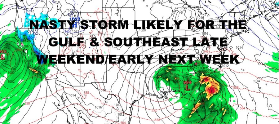
What we are watching is a system that’ll hit the West Coast with more flooding rains and big snow accumulations, then spin southeast and take a southern route along the Gulf. This will touch off another round of flooding rain, severe weather, and possibly even so coastal winds along the Southeast before going out to sea. This does have some potential as far as some big impacts, so we will be keeping a close eye on it. Right now the timeline looks to be mid to late weekend, into next Monday; with possibly some coastal impacts reaching into next Tuesday.
Stay tuned and we will watch it closely. Here is your local forecast –
SATELLITE
For today, rain is departing the East End of Long Island, but clouds are sticking around. We’ll have some partial clearing late, with highs near 40.
Tomorrow is a seasonably cold one, with sun and clouds and highs in the mid to upper 30’s.
WEATHER RADAR
The same pretty much goes for Wednesday, with some clouds sticking around, and rather seasonable with highs in the upper 30’s to near 40. Expect more sun & clouds Thursday with mid 40’s as we moderate a bit. Extra clouds return on Friday ahead of some reinforcing colder air. We could see a few light showers ending as as light mix or snow flurries. Highs in the mid 40’s again, but dropping late.
Your weekend is looking seasonably cold, mostly sunny, and breezy, with highs in the mid to upper 30’s as that vigorous system in the Southeast, passes well to our south and doesn’t come remotely close.
BE SURE TO DOWNLOAD THE FREE METEOROLOGIST JOE CIOFFI WEATHER APP &
ANGRY BEN’S FREE WEATHER APP “THE ANGRY WEATHERMAN!
MANY THANKS TO TROPICAL TIDBITS & F5 WEATHER FOR THE USE OF MAPS
Please note that with regards to any severe weather, tropical storms, or hurricanes, should a storm be threatening, please consult your local National Weather Service office or your local government officials about what action you should be taking to protect life and property.


