NYC AFTERNOON EVENING RUMBLES POSSIBLE AFTER HOT HUMID DAY
Good late morning everyone. We have a warm one ahead of us, and how warm we go depends on how long we hold onto this sunshine. Clouds are already starting to creep down from the north, associated with a cold front that’ll put an end to unseasonably warm and humid weather.
SATELLITE

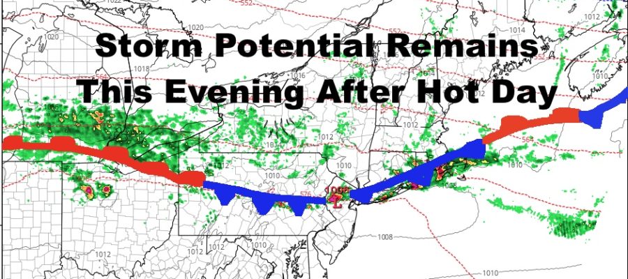
I’m a little skeptical if we can hit 90 degrees in Central Park officially, but being in the low to mid 80’s in many spots already, a little extra sunshine could push us there or at least close. Scattered showers will also start to sink southward while moving east along the airmass boundary. We’ll be watching closely for the development of any small waves along this front, and if it happens, we could see some heftier rumbles in or around the area between 5-8pm. Any individual cells will be capable of producing gusty winds and hail IF they develop.
After the heat, the big story will be the cool-off. We’ll drop 30+ degrees overnight and into the low to mid 50’s in most spots. We’ll also get that NE wind going with the help of high pressure to our north and east, and a warm front trying to come back into the area.
REGIONAL RADAR

That won’t happen and all the front will do, is provide us with a rainy and raw day tomorrow. Expect on and off showers throughout the day, cloudy skies, and highs barely reaching 60 if they reach 60 at all.
We’ll clear everything out Friday, but it’ll be a very windy and cool day. “Relatively brisk” will be a good way to describe it compared to the warm temps and lack of wind the past few weeks. Look for a steady northerly flow 15-25mph, and gusts could near or crack 40mph, especially before noon.
LOCAL RADAR NEW YORK CITY

Winds relax Friday night and into Saturday. This will help get some radiational cooling into the area, dropping temps into the 40’s in the NYC area. We’ll also see 30’s upstate, and maybe even a few 30’s out in the Pine Barrens of Long Island. Expect low 60’s as highs on Saturday, then we recover nicely into the low 70’s on Sunday as that airmass modifies rather quickly.
LOCAL RADAR PHILADELPHIA


MANY THANKS TO TROPICAL TIDBITS FOR THE USE OF MAPS
Please note that with regards to any tropical storms or hurricanes, should a storm be threatening, please consult your local National Weather Service office or your local government officials about what action you should be taking to protect life and property.