NYC Big Atlantic Storm Departs Fairly Quiet Workweek
Good morning everyone. We’re watching a very deep low pressure depart, which continues to give upper New England fits with heavy mixed precip and wind. It helped send some scattered snow showers to extreme Eastern Long Island, but most of LI and NYC remained unaffected. We settle into a fairly quiet week, with the best chance of some steady rain coming on Thursday.
SATELLITE

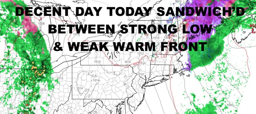
Clouds remain off to our ESE unless you’re on extreme eastern Long Island. Winds remain stiff due to our slow moving low pressure, but we’ll modify things into the mid 40’s today.
Clouds increase tomorrow ahead of a week warm front, but precip arrives too late and too unorganized for any early mixing or snow. Look for highs in the mid to upper 40’s with the slight chance of a few PM scattered showers.
WEATHER RADAR

Wednesday is the best day of the week, with sun & clouds and low 50’s for highs. We’ll cloud up Wednesday night with rain moving in between late morning and mid afternoon. We’ll be in the warm sector on this again, with mid to upper 40’s.
Sunshine returns again on Friday with mid 40’s and steady winds.

Your weekend remains steady and comfortable, with sunshine on Saturday and low to mid 40’s; then more low to mid 40’s on Sunday with the slight chance of a PM shower.
BE SURE TO DOWNLOAD THE FREE METEOROLOGIST JOE CIOFFI WEATHER APP &
ANGRY BEN’S FREE WEATHER APP “THE ANGRY WEATHERMAN!
MANY THANKS TO TROPICAL TIDBITS & F5 WEATHER FOR THE USE OF MAPS
Please note that with regards to any severe weather, tropical storms, or hurricanes, should a storm be threatening, please consult your local National Weather Service office or your local government officials about what action you should be taking to protect life and property.