NYC Brief Winter Touch Coming
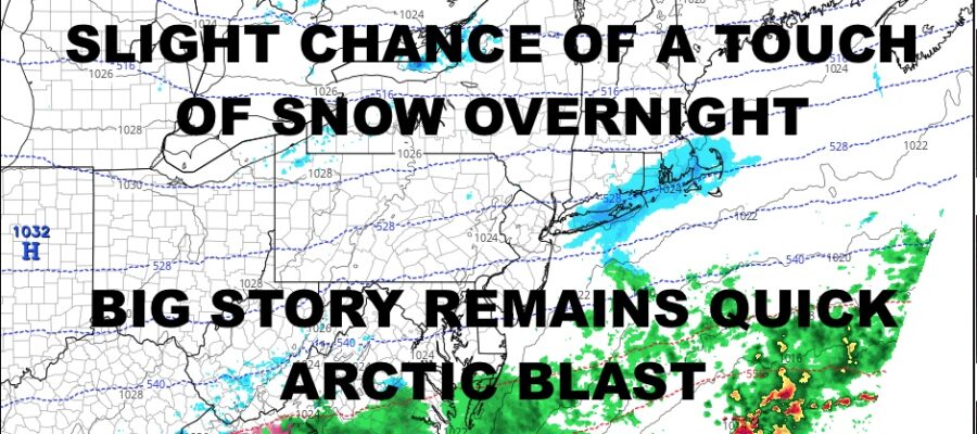
Good morning everyone. We have cloudy skies and those clouds will stick around through tomorrow as a front sinks to our south and some colder air works in. That’ll touch off some scattered light snow and we’ve already had a few flakes, but the big story remains Friday’s arctic blast that’ll give us the coldest air of the season (briefly).
SATELLITE

Look for clouds and a few scattered snow showers, especially along the South Shore and East End of Long Island this morning. Highs today will be in the 35-40 range. We’ll dry out a bit, then we’ll have another chance of some light snow late overnight. Best chance to see some flakes will be Central and Eastern Long Island.
Clouds stick around tomorrow and it’ll be a seasonably cold one. Expect highs in the mid 30’s in most spots.
WEATHER RADAR

Thursday is a transition day before the real cold sets in. We’ll have sunshine, increasing winds, and highs near 40. The cold air begins to move in overnight Thursday, with lows in the 20-25 range.
On Friday, we are looking for a blustery day with early highs in the 25-30 range, then we will free-fall near sunset. Lows overnight will be in the 0-5 category, with negative temps possible in the Pine Barrens of Long Island and areas N&W of NYC.

Saturday is a lost cause with mid to upper teens as highs, then we will hold steady overnight, with maybe a few spots dipping into the lower teens. Milder air returns on Sunday with highs in the upper 30’s to low 40’s and increasing clouds.
BE SURE TO DOWNLOAD THE FREE METEOROLOGIST JOE CIOFFI WEATHER APP &
ANGRY BEN’S FREE WEATHER APP “THE ANGRY WEATHERMAN!
MANY THANKS TO TROPICAL TIDBITS & F5 WEATHER FOR THE USE OF MAPS
Please note that with regards to any severe weather, tropical storms, or hurricanes, should a storm be threatening, please consult your local National Weather Service office or your local government officials about what action you should be taking to protect life and property.