NYC Chilly Week Eyes Shift Towards Coastal/Near Coastal System
Good morning everyone. As our oddity-of-a-system departs and sun returns today, we shift our focus to the next system with slightly below average temps take hold across the area. Overall and regardless of what exactly our next system does, we are entering a decidedly colder pattern, with average or slightly below average December temps.
SATELLITE

Morning clouds will give way to afternoon sun today, but it won’t do much to help us warm up as we hang out in the upper 30’s to near 40. Last night’s system saw one of the scenarios I spoke about unfold, with heavier precip cooling the atmosphere, allowing snow to sink southward towards NYC and Long Island; with snow pushing past the north shore and covering most of the Island. Central Park and JFK saw a trace of snow, while locales on the North Shore of Long Island and Central Suffolk saw .25 to a 1/2″ of snow. Areas of the Catskills and Poconos fell into that 3-6″ snowfall, and overall everything worked out as expected with a few minor “surprises”.
Overnight tonight we go fairly cold, with clear skies and lows in the low to mid 20’s. We’ll recover a little bit tomorrow, with sunshine and highs in the near 40 range. Look for a repeat on Wednesday, then we begin to watch Thursday and Friday’s system.
WEATHER RADAR

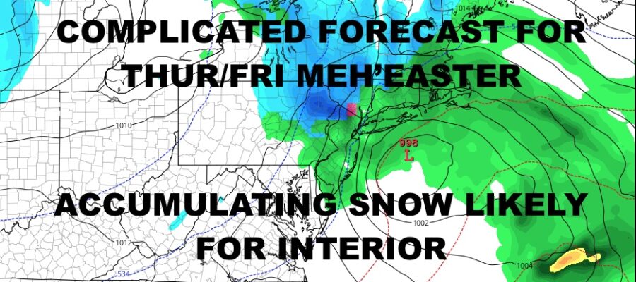
We still have a ways to go on this, but right now we’ll have increasing clouds Wednesday night, with a continuing lowering and thickening of clouds Thursday morning. We’ll have the chance of cold rain by mid to late afternoon, and interior parts of the Northeast should see a mix or snow developing. We won’t get into rain/snow lines yet as it’s too early, but a cold rain is almost a certainty here with highs in the low 40’s.
Cold rain continues overnight Thursday with upper 30’s, then a raw, rainy, and windy day Friday with lingering rain and mid 40’s. Wherever the snow sets up, a wide swath of 6-10″ will be possible, with higher amounts possible in higher elevations (10-14″+), but it’s looking as if NYC misses out on this one with development too close to the coast or just inland, then strengthening which happens too late.

After our first semi-big system of the season departs the area, we’ll have decreasing clouds Saturday with more near 40 temps; then sunshine and near 40 temps Sunday. Average temperature this time of year is 43-45 degrees for NYC depending on your source, so we are close to or just below average.
BE SURE TO DOWNLOAD THE FREE METEOROLOGIST JOE CIOFFI WEATHER APP &
ANGRY BEN’S FREE WEATHER APP “THE ANGRY WEATHERMAN!
MANY THANKS TO TROPICAL TIDBITS & F5 WEATHER FOR THE USE OF MAPS
Please note that with regards to any severe weather, tropical storms, or hurricanes, should a storm be threatening, please consult your local National Weather Service office or your local government officials about what action you should be taking to protect life and property.