
Weather in 5/Joe & Joe Weather Show Latest Podcast
NYC Cloudy Cool Day Today Before Heat Returns Tomorrow
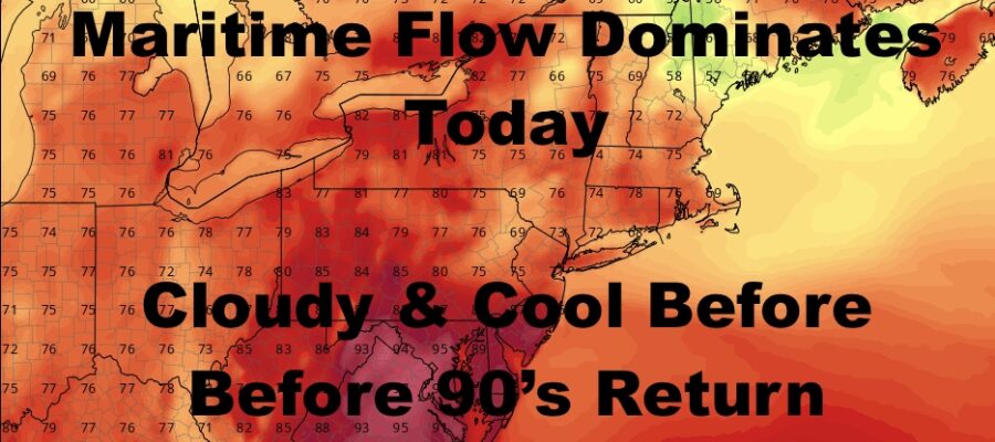
Good early morning everyone. After storms stayed away from our area yesterday and mostly impacted parts of NJ and upstate NY, we have our transition day today with a maritime flow dominating. This is because we’re on the “wrong” side of a stationary/warm warm, but that front will be on the move overnight.
SATELLITE

Look for cloudy/mostly cloudy skies today, an easterly flow, and highs in the upper 70’s. Some spots may hit 80 if we get some blue patches. It’ll also be on the humid side even though it’s below average temp-wise.
WEATHER RADAR

Tomorrow we go very warm to hot, with clouds and sun & upper 80’s to near 90. We may also see some afternoon storms, but the action will be scattered and we will be playing this game all week in terms of watching the radar.
We’ll have some extra sun on Thursday with highs near 90, then go into the low 90’s Friday. Each day will have the slight chance of a thunderstorm.

For your weekend, we may squeeze out one more day of 90 degree temps, with a better chance of storms on Saturday. They won’t do much of a good job cooling us off, because we’re back on Sunday with more humidity and upper 80’s. Again, slight chance of storms Sunday afternoo
BE SURE TO DOWNLOAD THE FREE METEOROLOGIST JOE CIOFFI WEATHER APP &
ANGRY BEN’S FREE WEATHER APP “THE ANGRY WEATHERMAN!

MANY THANKS TO TROPICAL TIDBITS & F5 WEATHER FOR THE USE OF MAPS
Please note that with regards to any severe weather, tropical storms, or hurricanes, should a storm be threatening, please consult your local National Weather Service office or your local government officials about what action you should be taking to protect life and property.