
COUPON CODE SUMMER24 GET 10% OFF
(Tempest is an affilllate of Meteorologist Joe Cioffi & earns commissions on sales.)
NYC Dry Period Continues
01/23/25 10:29am EST
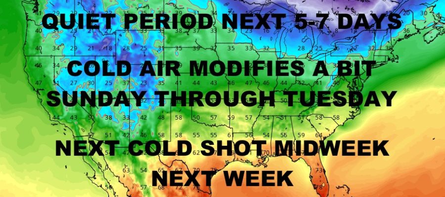
Good morning everyone. Now that we pretty much have all of our weather events out of the way, we are relatively dry and quiet across a wide area of real estate. Cold weather remains locked into the Northeast, Southeast, and South, but things will begin to slowly modify.
In the Northeast, dry conditions will be the name of the game through at least Tuesday. We’ll also step away from the frigid conditions and slowly return to average or near-average temperatures. The next chance of rain or snow looks to be some time between late Tuesday and early Thursday with a reinforcing shot of very cold air.
The main focus in this forecast will be a return to more typical weather along the Gulf Coast next week. After historic snowfalls in Texas, Louisiana, Alabama, Mississippi, Alabama, and Florida, we return to more milder conditions and the prospect of some heavy rain and thunder.
Things will look eerily similar to early this week as a new cold front fails to clear the Southeast. After bringing a reinforcing shot of cold air into the Northeast midweek, the solution is a little warmer for the South. Look for moisture once again to bubble up from the Gulf of Mexico on the back side of high pressure, but extremely cold air won’t be in place like it was this week.
We’ll still see the possibility for some snows down in central Texas or parts of the Midwest depending on the final positioning of this system; but it’ll be a rainy and thundery time along the Gulf Coast of Texas, Louisiana, and Mississippi some time between late Thursday, onward. This will be a slow moving system that’ll eventually bring milder conditions and rain to Florida, Georgia, and South Carolina as well.
We’ll also watch closely to see if a severe weather component becomes an issue at some point. Here is your local NYC Metro forecast –
SATELLITE

Look for a mix of sun & clouds today, with highs in the upper 20’s at best. Lows sink back into the 15-20 range overnight tonight. We’ll ahem more up the same tomorrow, with upper 20’s to low 30’s as highs.
WEATHER RADAR

We continue on the very cold side for Saturday, then some near 40 degree temps possible on Sunday.

Monday and Tuesday look sunny with upper 30’s to near 40, then increasing clouds late on Tuesday as we watch for our next possible front on Wednesday.
BE SURE TO DOWNLOAD THE FREE METEOROLOGIST JOE CIOFFI WEATHER APP &
ANGRY BEN’S FREE WEATHER APP “THE ANGRY WEATHERMAN!
MANY THANKS TO TROPICAL TIDBITS FOR THE USE OF MAPS
Please note that with regards to any severe weather, tropical storms, or hurricanes, should a storm be threatening, please consult your local National Weather Service office or your local government officials about what action you should be taking to protect life and property.