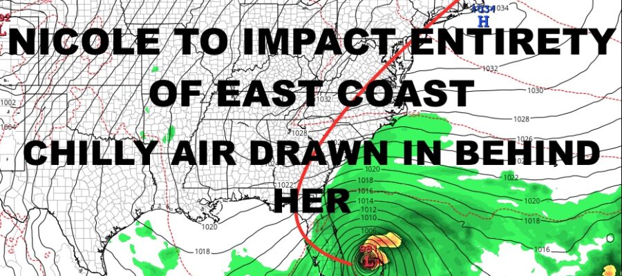
NYC Election Day 2022 Tropical Update
Good morning everyone and happy Election Day 2022. Obviously we have a lot going on weather-wise, and we address it all here. We are closely watching Subtropical Storm Nicole, which will most likely slam the east coast of Florida as a Category 1 hurricane, then begin to ride the I95 corridor and up the coast (inland route). Subtropical systems are very tricky in terms of what they have to offer, and the biggest problem with them is that people downplay what they’re capable of. With wide circulations and different structure, storm surge is always my biggest concern because it’s less localized and can impact a wide area.
SATELLITE

Locally, we have breezy conditions as cool air has worked its way in. We’ll have sunshine and mid 50’s both today and tomorrow, but winds settle down by sunrise tomorrow for a more comfortable day.
We’ll see milder temps Thursday with sunshine remaining till late, and highs should be in the low to mid 60’s.
WEATHER RADAR

Clouds will lower and thicken Friday while winds begin to pick up as well. At that point, Nicole will have already hit Florida and now riding up our front towards the Mid-Atlantic and Northeast via a more inland route. Expect rain developing by early afternoon, becoming steady, heavier, and more of a windswept nature by late Friday. Flash flooding will be possible in poor drainage areas, but any coastal flooding should be held to a minimum and minor in nature.
Rain comes to an end by early Saturday, and early highs in the low to mid 60’s will give way to a drop in temps as Nicole scoots by. Don’t be surprised if we’re in the 40’s & 50’s by sunset, while lows overnight drop into the mid to upper 30’s. Sunday & Monday both remain on the breezy and chilly side, with sunshine and mid to upper 40’s at best.

As for Florida, Subtropical Storm Nicole will go tropical and reach Hurricane strength before landfall. Right now we are looking at an overnight landfall late Thursday night, and it should be a Category 1/strong Category 1 when she reaches the coast. Obviously category 1 winds can still down trees and cause roof damage, but we are not looking at the wide devastation we saw with Ian.
However, local tornado activity can and will do major damage where it occurs, so you should take proper precautions when deciding what’s best for yourselves and family. Also, the storm surge remains my big concern when considering Nicole’s subtropical roots and angle of attack.
Landfall remains to lean towards somewhere between West Palm and Daytona, but a 5ft storm surge may be far-reaching and well north of landfall. Areas such as St Augustine, Jacksonville, and maybe even Charleston, SC, should take notice and take action to protect life and property.
BE SURE TO DOWNLOAD THE FREE METEOROLOGIST JOE CIOFFI WEATHER APP &
ANGRY BEN’S FREE WEATHER APP “THE ANGRY WEATHERMAN!
MANY THANKS TO TROPICAL TIDBITS & F5 WEATHER FOR THE USE OF MAPS
Please note that with regards to any severe weather, tropical storms, or hurricanes, should a storm be threatening, please consult your local National Weather Service office or your local government officials about what action you should be taking to protect life and property.