NYC Final Storm Phase Gathering Up
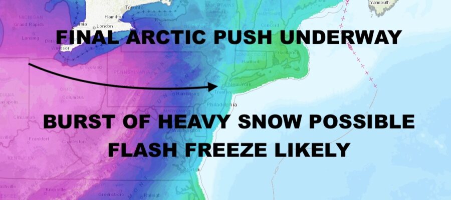
Good late morning everyone. We’re about to experience the final phase of our major storm, with arctic air about to push through as our last round of precipitation is knocking on the door. We’ve had moderate to major coastal flooding in the spots we pointed out over the past few days, and flood prone spots have seen 1-3ft of water inundation. While not life threatening, there was damage done to cars left in the streets (or foolishly driven through saltwater), basements, and first floors of some residences. Now we will take a kick to the ribs while we’re down, in the form of a flash freeze that’s about to blow through.
SATELLITE
Temps in the mid to upper 40’s as we speak, will quickly drop into the upper teens to low 20’s by evening. Our last round of rain is nearing Staten Island, with a sharp rain/snow entering eastern PA and moving east rapidly. We’ll have to see if the line holds together without drying up, but we could see a burst of heavy snow as the last spoke of our system moves through and arctic air moves in. So far that line is holding together.
Expect a flash freeze this evening and frigid conditions overnight. Anything wet or white will freeze as temps drop rapidly and into the single digits/low teens overnight.
WEATHER RADAR
We don’t recover much tomorrow, with even slightly colder temps expected that previously forecasted. Look for highs in the low 20’s at best, with low to mid teens overnight for Christmas Eve/Christmas morning. It’ll also remain very blustery with wind chills in the negative or positive single digits.
Temps for Christmas Day remain very cold, with more sunshine and highs in the low to mid 20’s. Teens remain overnight, then we begin to slowly recover.
To start the final week of 2022, winter is in full gear. We’ll have 25-30 degree temps for Monday, then low to mid 30’s on Tuesday. Hopefully by Thursday we thaw out a little bit, with maybe a few 40-45 degree temps around.
So far for New Years Eve, we are looking “mild” and breezy, but we’ll have to see how mild we go as our next system will be knocking on the door.
BE SURE TO DOWNLOAD THE FREE METEOROLOGIST JOE CIOFFI WEATHER APP &
ANGRY BEN’S FREE WEATHER APP “THE ANGRY WEATHERMAN!
MANY THANKS TO TROPICAL TIDBITS & F5 WEATHER FOR THE USE OF MAPS
Please note that with regards to any severe weather, tropical storms, or hurricanes, should a storm be threatening, please consult your local National Weather Service office or your local government officials about what action you should be taking to protect life and property.


