NYC Heavy Rain Possible Tonight
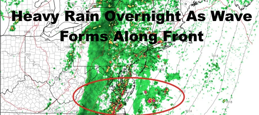
Good afternoon everyone. After some technical difficulties yesterday and this morning, I’m back with a rainy forecast. That’s a good thing though because we need it in the worst way. A cold front approaching the area will have a wave of energy forming along it, helping to enhance the rain and possible storms across the region.
SATELLITE

Clouds will be with us today, but aside from a sprinkle or shower here and there, the rain holds off for the most part. Highs today will be a humid mid to upper 70’s. Overnight, the rain will move in and it’ll be on and off throughout. Rain may be heavy at times, with localized flooding possible in poor drainage areas, and we may have a rumble or two of thunder as well.
Tomorrow morning is looking rainy for the school drop-off, then things will begin to settle down.
REGIONAL RADAR

Expect rain through some time between 10am-12pm tomorrow, then we’ll have some partial clearing late. Highs tomorrow will be in the upper 60’s to low 70’s.
Thursday and Friday, we’ll have sun and clouds, the very slight chance of a sprinkle, and highs in the 65-70 range.
LOCAL RADAR NEW YORK CITY

Your weekend is looking nice and seasonably cool. It’ll be a dry one as well, with highs in the mid to upper 60’s both days.
LOCAL RADAR PHILADELPHIA


Towards the end of Sunday and into next Monday, I’m holding off on the forecast to see whether or not an upper-air disturbance combines with a wave to our south to bring some clouds and showers. Other than that, the pattern itself looks cool-air-dominant and very October-like as we enter the first & second week of the month.
MANY THANKS TO TROPICAL TIDBITS FOR THE USE OF MAPS
Please note that with regards to any tropical storms or hurricanes, should a storm be threatening, please consult your local National Weather Service office or your local government officials about what action you should be taking to protect life and property.