NYC Hot Humid Possible Thundery Day Today & Early Fall Visit Sunday
Good morning everyone. As Hurricane Laura continues to trudge north, we’ll get a better understanding of amount of damage caused by her landfall as rescue crews are able to respond southward towards the bayou. Up here, we have a hot and humid one today, with a back door cold front approaching. That means the risk of some storms, but we don’t cool off just yet. We’ll be watching Laura’s remnants interact with a front by Saturday, then finally some comfortable relief Sunday.
SATELLITE

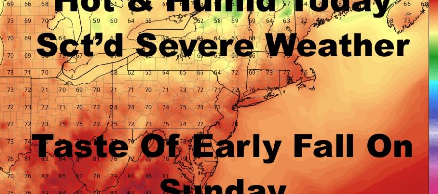
Expect AM clouds and some PM sun today. Then we’ll be watching that backdoor front to see how organized things get storm-wise. As stated yesterday, this type of approach is hard to forecast and things don’t gel the same in most instances. Any storms that do pop will potentially reach severe limits, with large hail, damaging winds, frequent lightning, torrential rain, and an isolated tornado possible. Highs today will be in the near 90/low 90 range and we’ll keep an eye on that radar for any action this afternoon and overnight.
REGIONAL RADAR

Tomorrow looks a little drier rain-wise and we may see some extra sunshine. That’ll equate to higher temps and we may reach 90 again. If not, upper 80’s are a sure bet, with the slight risk of an afternoon storm.
LOCAL RADAR NEW YORK CITY

On Saturday, the daisy chain of fronts will finally begin to pass all the way through, but not before sucking in Laura’s remnants first. That’ll enhance the chance of rain and embedded thunderstorms, and we also see some street flooding in poor drainage areas. Highs a muggy mid 80’s.
Sunday looks to be an absolute winner after some morning clouds, with breezy conditions, sunshine, and highs in the 75-80 realm.
LOCAL RADAR PHILADELPHIA


Monday and Tuesday both look to be comfortable days with sunshine and dry conditions; and highs continuing in that 75-80 range. Wednesday and beyond, we begin to turn up the warmth in increments.
MANY THANKS TO TROPICAL TIDBITS FOR THE USE OF MAPS
Please note that with regards to any tropical storms or hurricanes, should a storm be threatening, please consult your local National Weather Service office or your local government officials about what action you should be taking to protect life and property.