NYC Light Snow Accumulation Possible Wednesday
Good morning everyone. While the headline doesn’t allow me to emphasize, we can emphasize down here. Possible….. not Probable. First we focus getting our current system out of here, which is hanging around a little longer than expected, then we clear the air tomorrow and make room for our next system on Wednesday. We have a lot hanging on this one in terms of IF we will see some snow out of this, but it’s by the far the “best” chance of snow we’ve had all season (and that’s not saying much).
SATELLITE

Expect lingering clouds and showers today until late afternoon. While areas upstate could see some back end snows out of this, expect a cold rain here in the NYC Metro area. However, don’t be surprised if you see some departing flakes here or at minimum, a few globs hitting your windshield mixed in with the rain. Highs today will be in the upper 30’s to near 40. It’ll also be a little gusty out there, making it feel colder than it is.
Sunshine returns tomorrow, but the wind sticks around. We’ll have highs in the 40’s, but it’ll feel colder on the skin. Tuesday night remains a big factor in terms of what our chances are for some Wednesday morning snow. How cold do we get? That’ll depend on how fast the clouds move in. Remember, clouds act like a thermal blanket. As of now, expect lows in the upper 20’s to low 30’s. If 20’s are more widespread, we’ll have a better shot at pulling this off.
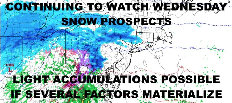
WEATHER RADAR

To add to the complexity, we also need to watch the moisture, how fast it gets here, and how fast the relatively “warmer” air is moving. How low we go Tuesday, how fast the moisture arrives, and how much moisture there is during the onset, will all play a role to determine if we get some overrunning snows.
For the moment, I’m going to call for light snow developing, changing to a mix of rain and wet snow by mid afternoon on Wednesday; little to no accumulation expected. However, the potential is there for a 1-2/2-4″ type snowfall IF….IF things are more robust moisture-wise the colder air is more stubborn. This is a scenario that is plausible and too early to rule out, so we’ll keep it around for the moment.

Clouds stick around Thursday with highs in the low to mid 40’s, then we go sunny and seasonably cold on Friday with 35-40 degree temps. So far your weekend is looking sunny and dry, highs in the low 40’s.
BE SURE TO DOWNLOAD THE FREE METEOROLOGIST JOE CIOFFI WEATHER APP &
ANGRY BEN’S FREE WEATHER APP “THE ANGRY WEATHERMAN!
MANY THANKS TO TROPICAL TIDBITS & F5 WEATHER FOR THE USE OF MAPS
Please note that with regards to any severe weather, tropical storms, or hurricanes, should a storm be threatening, please consult your local National Weather Service office or your local government officials about what action you should be taking to protect life and property.