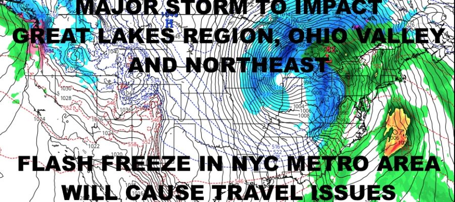
NYC Major Storm Creates Holiday Travel Woes
Good morning everyone. We’re enjoying some quiet but cold weather as we await our next system and all of the issues it’ll bring along with it. First and foremost, while this won’t be a major snowstorm for NYC, it will make headlines regardless; especially with travel headaches and a possible flash freeze. We also may be in line for a “White Christmas” if we still have some lagging moisture when the cold air arrives. We’ll go into it below after the 3 day forecast.
SATELLITE
Aside from some lake effect snow along the shores of Lake Ontario and a little bit along Lake Eerie, we are dry, chilly and quiet. We’ll have sunshine today and upper 30’s to near 40 at best. We’ll drop into the 20’s overnight, then recover back to the same conditions for tomorrow.
Wednesday remains on the quiet side, with more sunshine and more upper 30’s to near 40; which is actually slightly below average for this time of year.
WEATHER RADAR
We’ll begin to cloud up overnight Wednesday, then clouds will lower and thicken on Thursday. As of now, it seems like we hold off on the rain until late afternoon/ealry evening. That’ll dash any possibility of a brief mixing period before turning to all cold rain, and it’ll be just a plain rain for the onset and middle-stages.
We may still get a break in between the un-phased areas of energy as one piece passes by Thursday night and the other heads in Friday, but the gap is narrowing and we’ll keep an eye on it. If a break doesn’t occur, we’ll probably just see a lull in the form of light rain and drizzle, then steadier rain and wind developing again.
Winds will be on the hefty side as low pressure deepens in the Great Lakes region and finally absorbs the un-phased piece of energy; then we’ll be watching very closely for that cold air and what remains left of our moisture. As far as rain changing to a brief burst of snow, I’ll say we’re at a 60/40 chance of that happening. The big story though will be the sharp drop in temps, causing anything that’s wet, to freeze very quickly. High temps in the mid to upper 50’s, dropping into the mid teens overnight Friday, will cause treacherous conditions. Aside from black ice and patches of thicker ice, a sharp contrast can also cause water main breaks and power outages as tree limbs become brittle in the blustery winds & cold.
If snow does occur in NYC before the moisture is able to depart, I’m looking at a quick coating to an inch possible. With arctic air moving in, it’ll quickly stick and freeze, giving everything an icy white sheen. This is something that bears watching, but we’ll only know when we see the final setup, structure, and radar.
For your Christmas weekend, it’ll be sunny, dry, and very cold. Expect highs in the mid to upper 20’s, with teens overnight.
BE SURE TO DOWNLOAD THE FREE METEOROLOGIST JOE CIOFFI WEATHER APP &
ANGRY BEN’S FREE WEATHER APP “THE ANGRY WEATHERMAN!
MANY THANKS TO TROPICAL TIDBITS & F5 WEATHER FOR THE USE OF MAPS
Please note that with regards to any severe weather, tropical storms, or hurricanes, should a storm be threatening, please consult your local National Weather Service office or your local government officials about what action you should be taking to protect life and property.


