
Weather in 5/Joe & Joe Weather Show Latest Podcast
NYC Peak Winter Arrives Temp-Wise
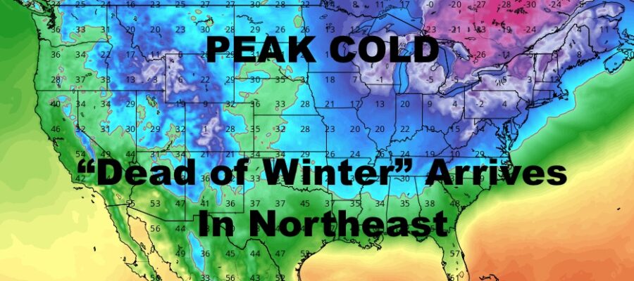
Good evening everyone. This morning’s snow underperformed, but we weren’t expecting much to begin with. Here at Angry Ben’s, we were calling for a coating to 2″ and mostly on colder surfaces. NYC officially saw a trace of snow, and some spots in Nassau and Suffolk saw 1/4 to almost 1/2″ of snow. So we fell into range, but on the very low end. The big “winner” was parts of CT, where spots saw 1-2″. That’s about it for that, I know people were excited, but I was not and this didn’t look like anything to begin with. Regardless, very cold air moves in and we will be in a cold-dominant pattern which signals the “dead of winter”.
SATELLITE

Partial clearing will ensue from west to east as temps drop into the 20’s with sunset. Lows overnight will dip into the low mid teens.
We don’t recover much with the sunshine tomorrow, and we hang out in the low to mid 20’s. Look for more low to mid teens tomorrow night as well.
WEATHER RADAR

We remain dry for the weekend, with sunshine and very cold conditions continuing for Saturday. We’ll have highs in the mid 20’s, then we drop a degree or two overnight as things modify. Sunshine and dry conditions remain Sunday, with low to mid 30’s for highs.

We start the workweek next week with AM sun, PM increasing clouds for Monday; and we’re a bit colder in the near 30 range. We’ll be keeping an eye out for some possible light snow on Tuesday with an Alberta Clipper-like system, and then we go back into the arctic tundra mid to late week.
BE SURE TO DOWNLOAD THE FREE METEOROLOGIST JOE CIOFFI WEATHER APP &
ANGRY BEN’S FREE WEATHER APP “THE ANGRY WEATHERMAN!

MANY THANKS TO TROPICAL TIDBITS & F5 WEATHER FOR THE USE OF MAPS
Please note that with regards to any severe weather, tropical storms, or hurricanes, should a storm be threatening, please consult your local National Weather Service office or your local government officials about what action you should be taking to protect life and property.