NYC Rain Departs Heat Sets In
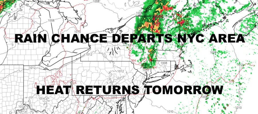
Good morning everyone. We have a few scattered thunderstorms departing the Forks of Long Island as we speak, and we have a little bit of weak energy leftover from our west that is about to push through. With the sun working the atmosphere now, we could see a few popcorn showers and storms over the next few hours before we begin to clear out and dry up. We’re talking drying up rain-wise, not humidity-wise, because that humidity and heat is going to come roaring back.
SATELLITE

We’ll have those few scattered showers and storms to contend with for a short time, then the sun returns with highs in the low to mid 80’s.
Tomorrow we begin to bake, with mostly sunny skies and highs near 90. It’ll be relatively humid out, but the real mugginess doesn’t begin till Wednesday.
WEATHER RADAR

For your Wednesday, expect the full, deep-summer experience in the NYC area. We’ll have humid conditions, mostly sunny skies (aside from some haze), and highs in the 90-95 range. We’ll “cool off” slightly on Thursday, but it will feel exactly the same with a downright muggy day and highs near 90.
We’ll do it again on Friday, but we turn up the juice even more and introduce more clouds. We’ll have the chance of some PM strong storms, and highs will range in the upper 80’s to near 90.

Our weekend is looking typical NYC deep-summer, with upper 80’s, sun & clouds, and the chance of PM storms each day. Some of those storms may reach severe limits.
BE SURE TO DOWNLOAD THE FREE METEOROLOGIST JOE CIOFFI WEATHER APP &
ANGRY BEN’S FREE WEATHER APP “THE ANGRY WEATHERMAN!
MANY THANKS TO TROPICAL TIDBITS & F5 WEATHER FOR THE USE OF MAPS
Please note that with regards to any severe weather, tropical storms, or hurricanes, should a storm be threatening, please consult your local National Weather Service office or your local government officials about what action you should be taking to protect life and property.