NYC Seasonable Week Ahead Before Warm Weekend
Hello and good morning to Angry Ben’s people. Yesterday we spoke of a cool week and the possibility of 80’s returning for next weekend. That idea begins to gain a lot of traction, but not before a cool week for those who enjoy the early fall stuff.
SATELLITE

The satellite shows a bank of clouds moving through the area. That represents the leading edge of cooler air heading in for tomorrow.
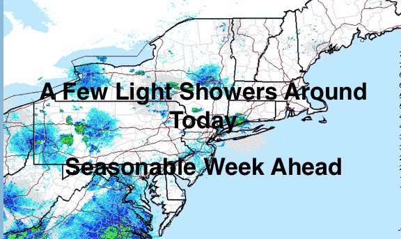
REGIONAL RADAR

Scattered showers dot the radar, and there could be a few stray ones here in the afternoon. Highs today in the upper 70’s, but if there’s some extra sunshine, 80 is not impossible.
LOCAL RADAR NEW YORK CITY

Tomorrow, the area dips into the mid 70’s with sunny skies returning. In fact, the sun sticks around all week, with varying temps. Wednesday looks like the coolest day with the core of the airmass heading through. Highs in the low 70’s.
On Thursday, mid 70’s return, then NYC creeps back up towards 80 on Friday. Our weekend continues to look very warm for this time of year with mid 80’s looking to return. A large frontal system will help bring up warm and humid air ahead of it, and the timing looks perfect for the weekend.
After a warm weekend, the long range is still showing some very cool pushes of air to end September.
LOCAL RADAR PHILADELPHIA


MANY THANKS TO TROPICAL TIDBITS FOR THE USE OF MAPS
Please note that with regards to any tropical storms or hurricanes, should a storm be threatening, please consult your local National Weather Service office or your local government officials about what action you should be taking to protect life and property.