NYC Severe Weather Breaks Heat Late Tomorrow
Good afternoon everyone. The extremely hot and uncomfortable weather conditions continue as our heatwave marches on. It’ll come to a screeching halt late Saturday, but it’ll come at the cost of severe storms in the NYC Metro Area. The thunderstorm line will also come down from a NNW angle, which is the worst way when it comes to severe weather risk in our area. After that, we cool down significantly, with low to mid 80’s expected Sunday through at least Friday.
SATELLITE

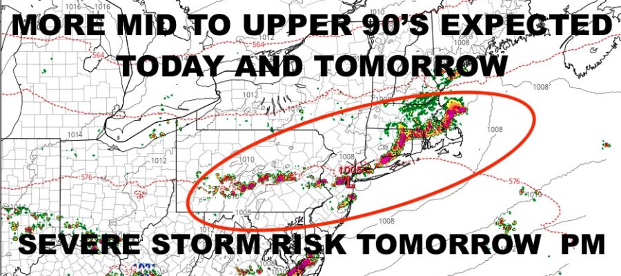
Expect full sunshine today and searing hot temps. We’ll do 95-100 again, with oppressive conditions and somewhat poor air quality. Stay inside if you can and drink plenty of water if going out.
We’ll start off sunny tomorrow, then increasing clouds late. Humidity will peak as that front nears, and storms will be heading in an almost north to south fashion later in the afternoon/evening. We’ll have to see if the line holds together, but if it does, hold onto your hats for some wild weather! Biggest risk will be large hail, damaging winds, frequent lighting, and tornados. Highs in the mid 90’s tomorrow.
Sunday will be a refreshing day, with a steady breeze, low humidity, and highs in the low to mid 80’s.
WEATHER RADAR

To start your workweek, expect sunshine Monday – Wednesday, with comfortably warm conditions in the low to mid 80’s.

BE SURE TO DOWNLOAD THE FREE METEOROLOGIST JOE CIOFFI WEATHER APP &
ANGRY BEN’S FREE WEATHER APP “THE ANGRY WEATHERMAN!
MANY THANKS TO TROPICAL TIDBITS & F5 WEATHER FOR THE USE OF MAPS
Please note that with regards to any severe weather, tropical storms, or hurricanes, should a storm be threatening, please consult your local National Weather Service office or your local government officials about what action you should be taking to protect life and property.