NYC SNOW FORECAST LOOKING SOLID
NYC SNOW FORECAST LOOKING SOLID
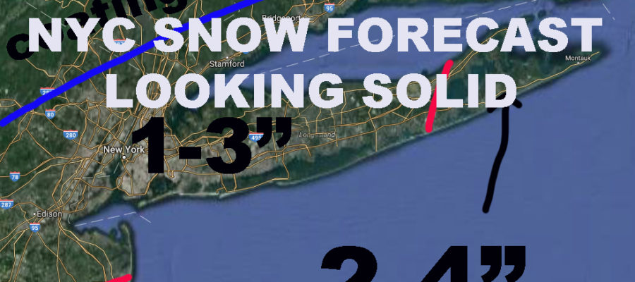
NYC SNOW FORECAST LOOKING SOLID – This morning I’m taking a look at the maps and I’m sticking to my original forecast, continuing to go slightly “rogue” from the National Weather Service. Clouds increase today and the west breeze will continue, highs in the mid 30’s. Tonight, the wind calms down and light snow begins between 8-10pm, lows in the upper 20’s, so everything sticks. Snow continues into the night and into early tomorrow morning before tapering off. Expect 1-3″ in most of the area, with higher end of that spectrum on the south facing shores of the NYC area. In the metro area, Central NJ and Eastern LI will see the potential for 2-4″.
Friday night will be cold and blustery, lows near 20. For Saturday, we begin to watch the system affecting the Southeast as models bring it slightly closer. As stated in previous forecasts, we could see a few flurries in the area, but we will keep an eye on it in case things change. The biggest story I think for this weekend, will be the cold, with highs only in the mid to upper 20’s and lows in the mid to upper teens. So for tomorrow AM, give yourself some extra time because rush hour will be sloppy, and bundle up good for a frigid weekend. Temps will modify mid week next week and we return to our previous pattern.

Satellite shows the milky white clouds heading across the Ohio/Tennessee valley which will be our weather maker tonight into tomorrow AM.
Moisture beginning to show up on the NE quadrant radar. Things will continue to fill in as the day goes on.
FiOS1 News Weather Forecast For Long Island
FiOS1 News Weather Forecast For New Jersey
FiOS1 News Weather Forecast For Hudson Valley
NATIONAL WEATHER SERVICE SNOW FORECASTS
LATEST JOESTRADAMUS ON THE LONG RANGE
Weather App
Don’t be without Meteorologist Joe Cioffi’s weather app. It is really a meteorologist app because you get my forecasts and my analysis and not some automated computer generated forecast based on the GFS model. This is why your app forecast changes every 6 hours. It is model driven with no human input at all. It gives you an icon, a temperature and no insight whatsoever.
It is a complete weather app to suit your forecast needs. All the weather information you need is right on your phone. Android or I-phone, use it to keep track of all the latest weather information and forecasts. This weather app is also free of advertising so you don’t have to worry about security issues with your device. An accurate forecast and no worries that your device is being compromised.
Use it in conjunction with my website and my facebook and twitter and you have complete weather coverage of all the latest weather and the long range outlook. The website has been redone and upgraded. Its easy to use and everything is archived so you can see how well Joe does or doesn’t do when it comes to forecasts and outlooks.
Just click on the google play button or the apple store button on the sidebar for my app which is on My Weather Concierge. Download the app for free. Subscribe to my forecasts on an ad free environment for just 99 cents a month.
Get my forecasts in the palm of your hand for less than the cost of a cup of Joe!


