NYC SNOWMAKER QUESTIONS CONTINUE

NYC SNOWMAKER QUESTIONS CONTINUE
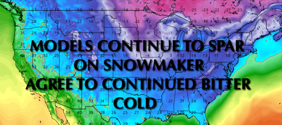
NYC SNOWMAKER QUESTIONS CONTINUE – Good morning everyone. Bitter cold is here to stay for a while, yet questions continue to arise about the possibility of any snow for the NYC Metro Area.
Temps are in the teens this morning, and we’ll only make it into the low to mid 20’s. Tomorrow will be the peak of this cold core of air, with sunny skies and highs only in the upper teens to near 20, then lows in the single digits to low teens.
The fact that we are a touch colder than expected, makes me skeptical for any big snow maker. Typically in our area, when we get this cold, it’s too dry and/or systems are suppressed well South/out to sea.
That being said, a few models still hold onto the idea snow in the area for Friday eve/Saturday with the help of an enhanced clipper. However, it’s still not the 20-40” snowmageddon depicted several days ago and each run seems to make it less impressive.
On the other end of the spectrum, our GFS model continues to push everything well south and eliminates the chance of any enhanced clipper. It shows cold air winning out in a big way, with bitter cold and dry conditions for the next 7-10 days.
Regardless, all models agree that cold is here to stay, and whether we get snow or not Saturday, a reinforcing shot of bitter cold air moves in. We’ll “modify” into the mid 20’s Friday and Saturday, then slip back to near 20 or low 20’s Sunday through at least next Friday. Single digits and low teens as lows will be a staple around here for a while.
After this extended block of bitter cold air, we’ll wait to see if we can squeeze out any front-related warmth. However, in the ultra long range, cold air looks to build up again in Canada and invade the lower 48 once again.
Long and short, we’re experiencing a true winter here in the NYC area, whether we see large amounts of snow or not this season is the only question. Stay tuned!


NATIONAL WEATHER SERVICE SNOW FORECASTS
LATEST JOESTRADAMUS ON THE LONG RANGE
GET ANGRY BEN A NICE CIGAR!

Weather App

Don’t be without Meteorologist Joe Cioffi’s weather app. It is really a meteorologist app because you get my forecasts and my analysis and not some automated computer generated forecast based on the GFS model. This is why your app forecast changes every 6 hours. It is model driven with no human input at all. It gives you an icon, a temperature and no insight whatsoever.
It is a complete weather app to suit your forecast needs. All the weather information you need is right on your phone. Android or I-phone, use it to keep track of all the latest weather information and forecasts. This weather app is also free of advertising so you don’t have to worry about security issues with your device. An accurate forecast and no worries that your device is being compromised.
Use it in conjunction with my website and my facebook and twitter and you have complete weather coverage of all the latest weather and the long range outlook. The website has been redone and upgraded. Its easy to use and everything is archived so you can see how well Joe does or doesn’t do when it comes to forecasts and outlooks.
Just click on the google play button or the apple store button on the sidebar for my app which is on My Weather Concierge. Download the app for free. Subscribe to my forecasts on an ad free environment for just 99 cents a month.
Get my forecasts in the palm of your hand for less than the cost of a cup of Joe!