
Weather in 5/Joe & Joe Weather Show Latest Podcast
NYC Unseasonably Cold Air Paying Brief Visit
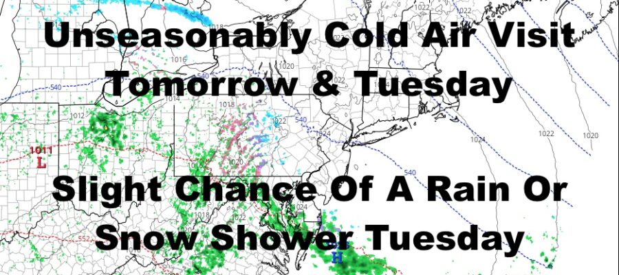
Good morning everyone. We have a sunny & windy day today, and that wind precedes much colder air heading in for tomorrow and Tuesday. We’ll have a couple of weak systems to deal with during the workweek, but they’ll be of little significance.
SATELLITE

Sunshine and seasonable temps stick around today, but those winds won’t make it feel very seasonable. Expect highs in the upper 40’s to near 50, with wind gusts approaching 35-40mph. We also have red flag warnings up for low humidity, the wind, and a very dry ground. Those conditions combined could help spread fires easily in wooded areas and dry marshland.
F5 WEATHER RADARS

Cold air rushes in tomorrow, with steady winds and highs only in the mid to upper 30’s. We cloud up on Tuesday as a weak system approaches, and that could touch off a widely scattered rain or snow shower. Best chance for that precip to be a snow shower, will be N&W of NYC. Highs Tuesday in the upper 30’s to near 40.

Cloudy skies stick around Wednesday through Friday with another system approaching Thursday/Friday. This one also appears to be weak when it reaches us, but it has a better chance of touching off some rain compared to Tuesday. Highs Wednesday and Thursday will be in the upper 40’s to near 50, then we cool off a bit Friday.
Overall, we are are experiencing typical NYC March weather in March. There’s nothing out of the ordinary going on, and nothing insane in either direction is on the short or medium range scope.
BE SURE TO DOWNLOAD THE FREE METEOROLOGIST JOE CIOFFI WEATHER APP &
ANGRY BEN’S FREE WEATHER APP “THE ANGRY WEATHERMAN!

MANY THANKS TO TROPICAL TIDBITS & F5 WEATHER FOR THE USE OF MAPS
Please note that with regards to any severe weather, tropical storms, or hurricanes, should a storm be threatening, please consult your local National Weather Service office or your local government officials about what action you should be taking to protect life and property.